


Scroll to begin the journey, or use the buttons below to see an overview or go straight to a key site.


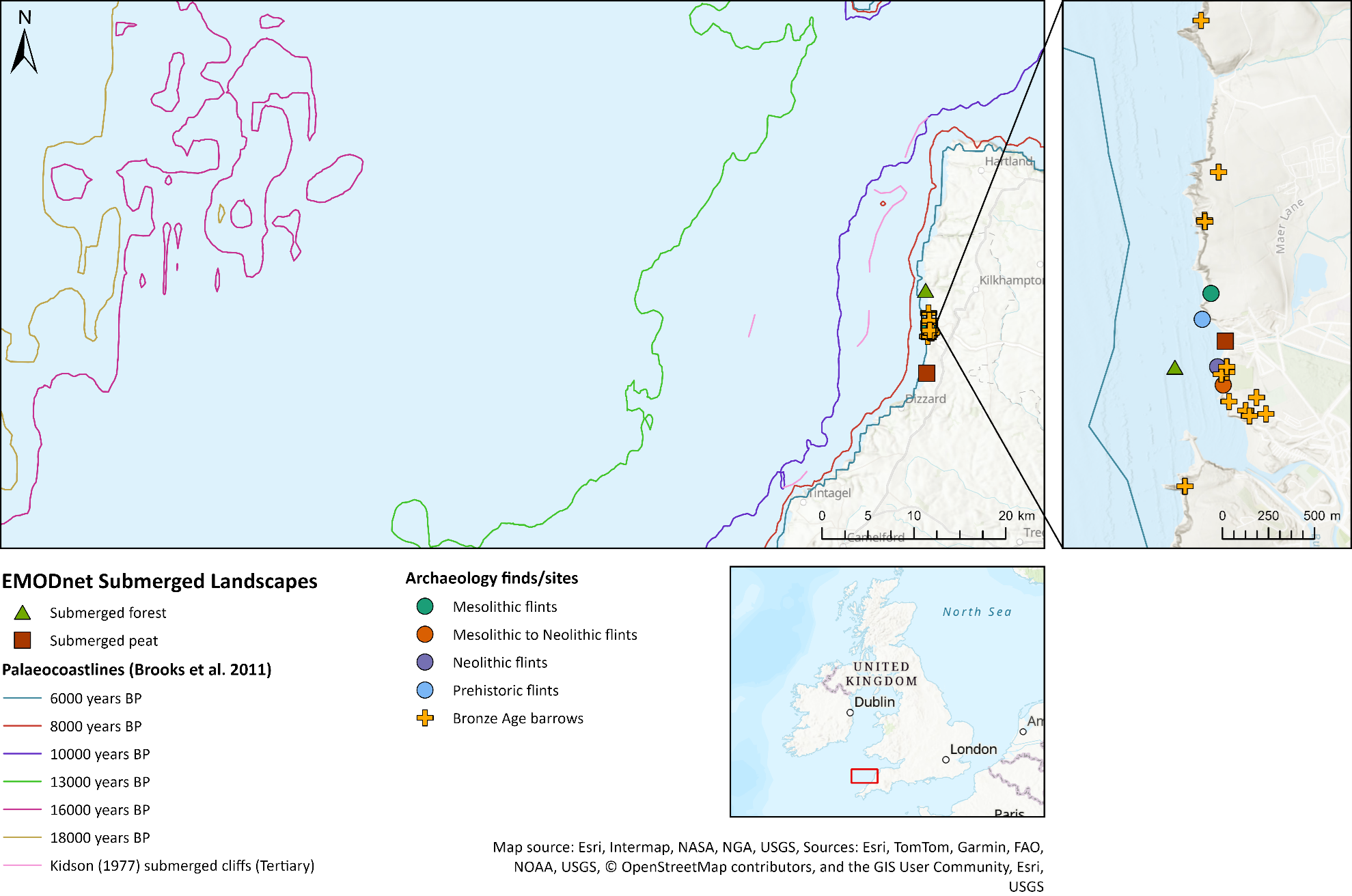
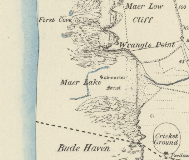
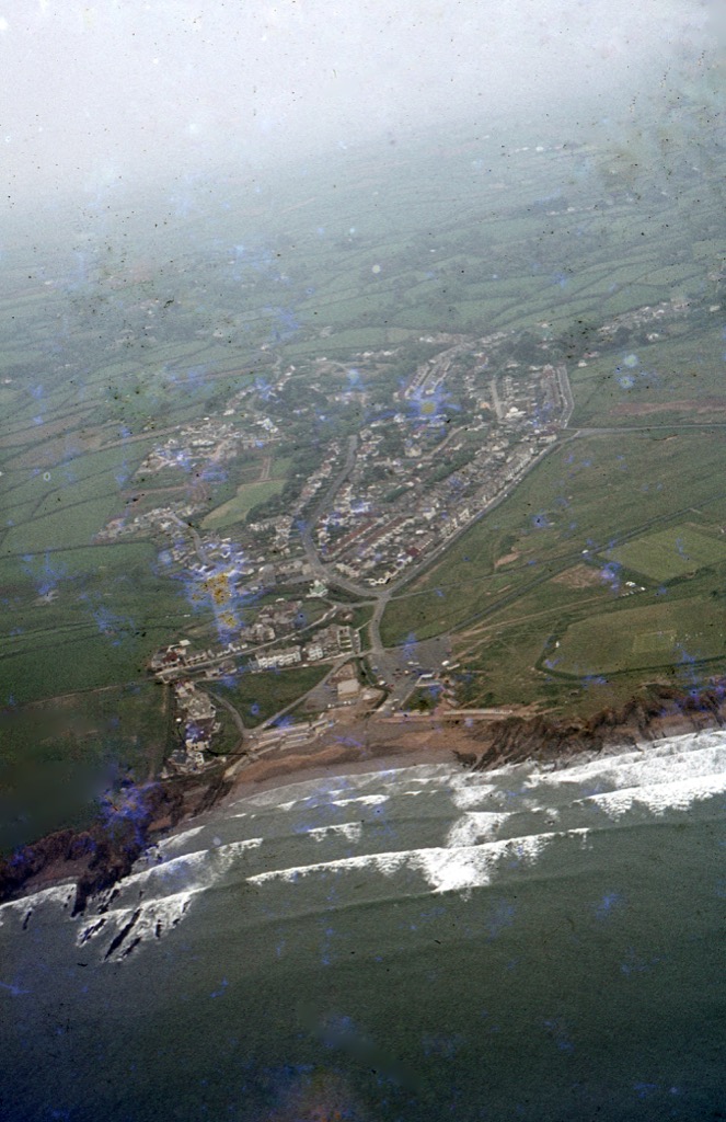
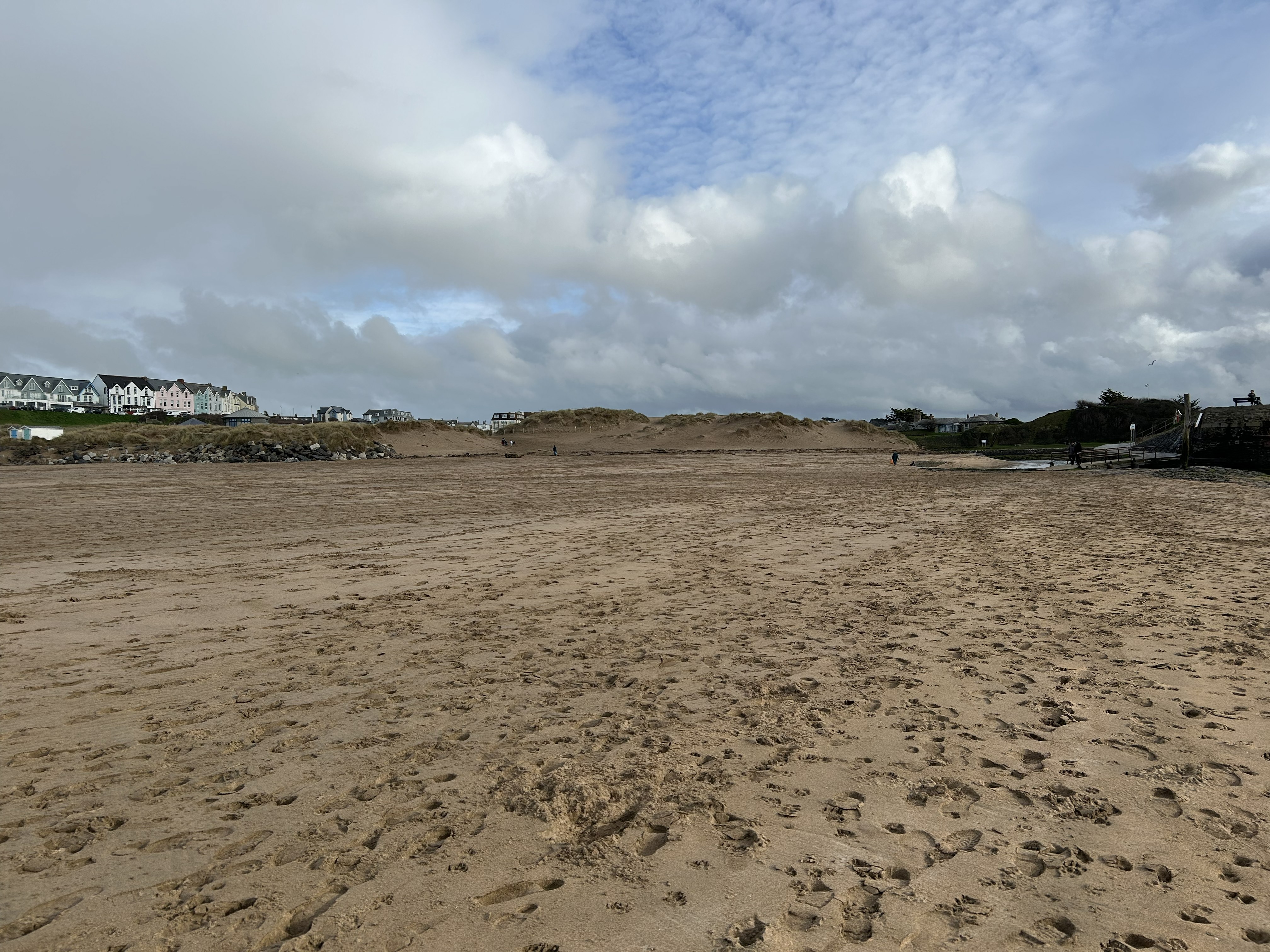
Several thousand years ago, the coastline at Bude lay far to the west of its present position. The areas now known as Crooklets, Summerleaze and the harbour formed part of a low lying landscape of woodland, wetlands and freshwater channels. Evidence of this survives beneath today’s beaches and around the river valley, where peat deposits and remains of a submerged forest are periodically exposed after major storms and have been encountered during cable installations and borehole sampling. These buried landscapes show that the sea has gradually advanced across this landscape over millennia. Archaeology adds a human dimension to this environmental story. Mesolithic and Neolithic flint tools, including leaf-shaped arrowheads, have been recorded on the surrounding Downs, demonstrating that people were present here as the coastline shifted. Rather than a fixed shoreline, early communities experienced a changing coast, returning and adapting as river channels, dunes and tidal inlets constantly shifted.
Future Coast Bude (FCB) is a Defra-funded project led by Cornwall Council that aims to support practical adaptation to climate change along Bude’s coastline. As part of the project, the Maritime Archaeology Trust (MAT) was commissioned to investigate how the coastline has changed over time and to develop an historic baseline for understanding long-term coastal change.
To do this, MAT brought together a wide range of historical, archaeological and environmental information to build a picture of how Bude’s coast has evolved. By combining these different sources of evidence, the project reveals how the shoreline has shifted, how people have used the coast through time, and how human activity has shaped the landscape seen today.
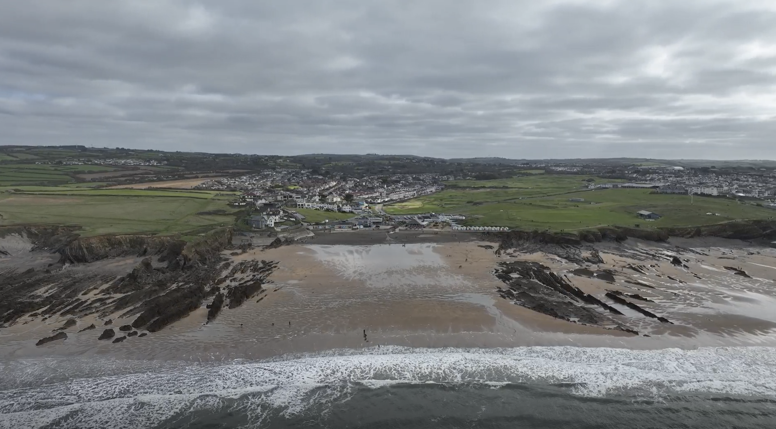
Crooklets Beach is a site of deep history and constant change. Click below to explore the layers of its past and future.
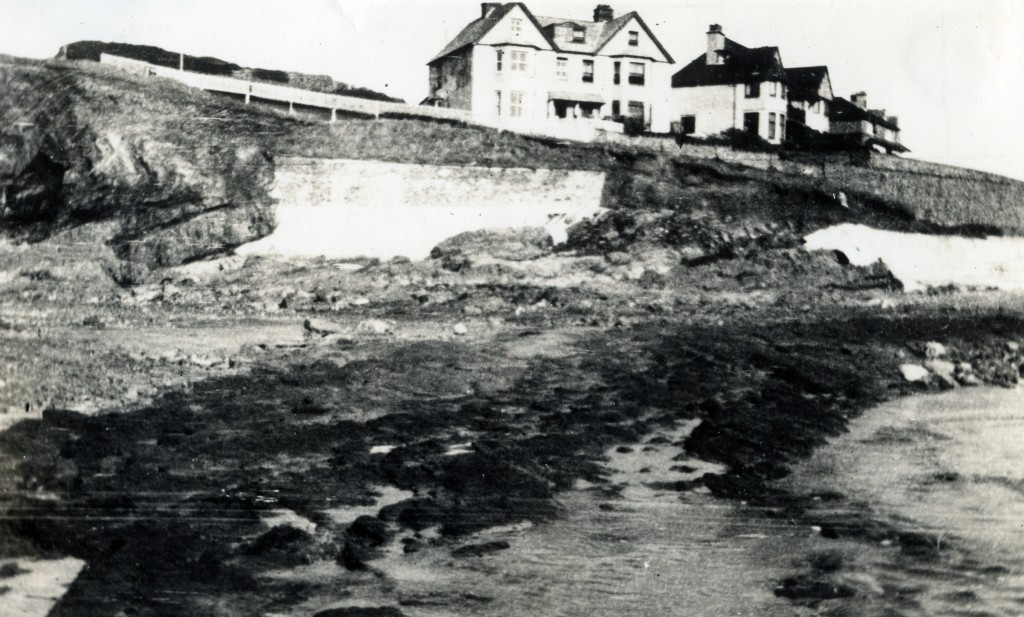
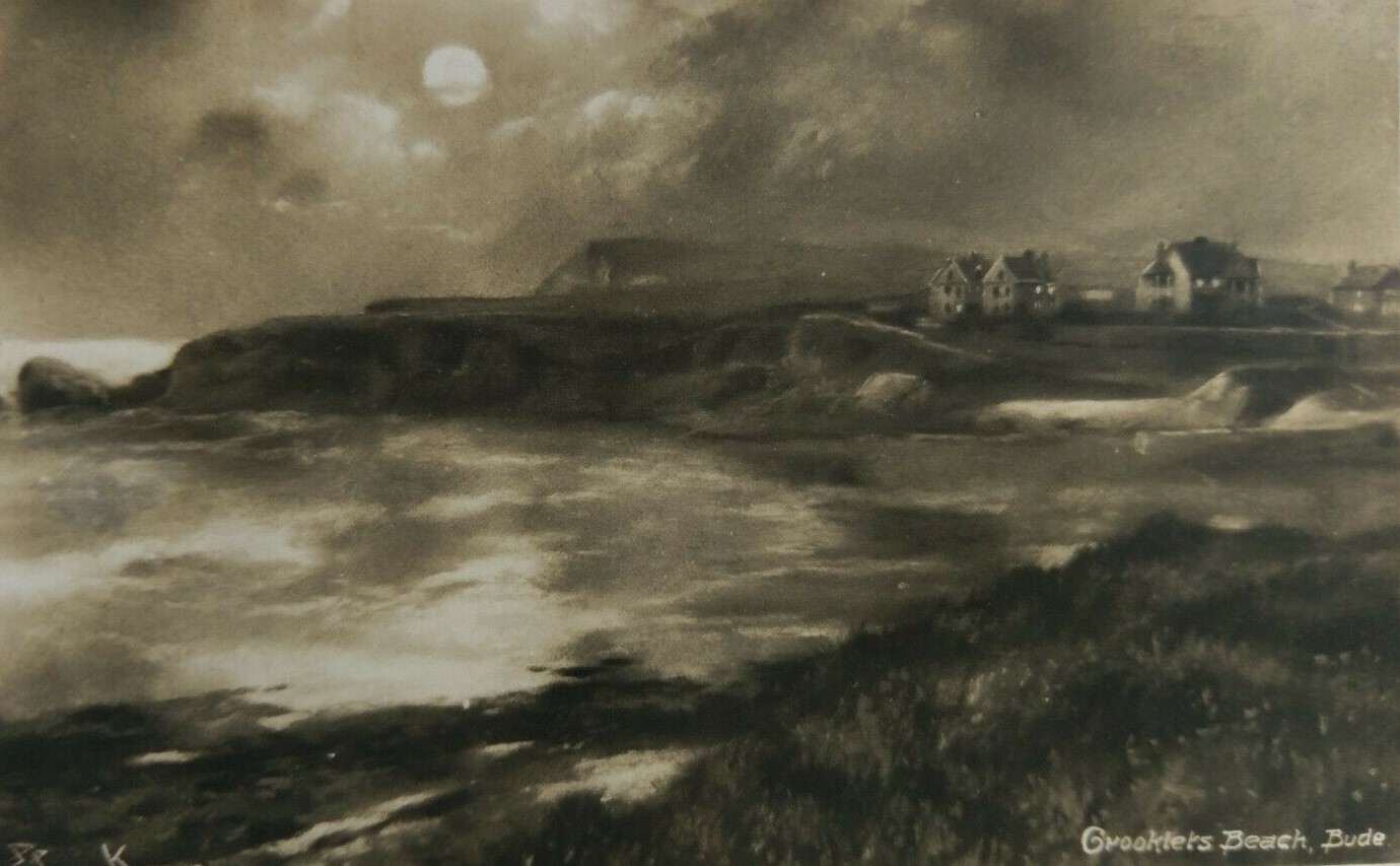
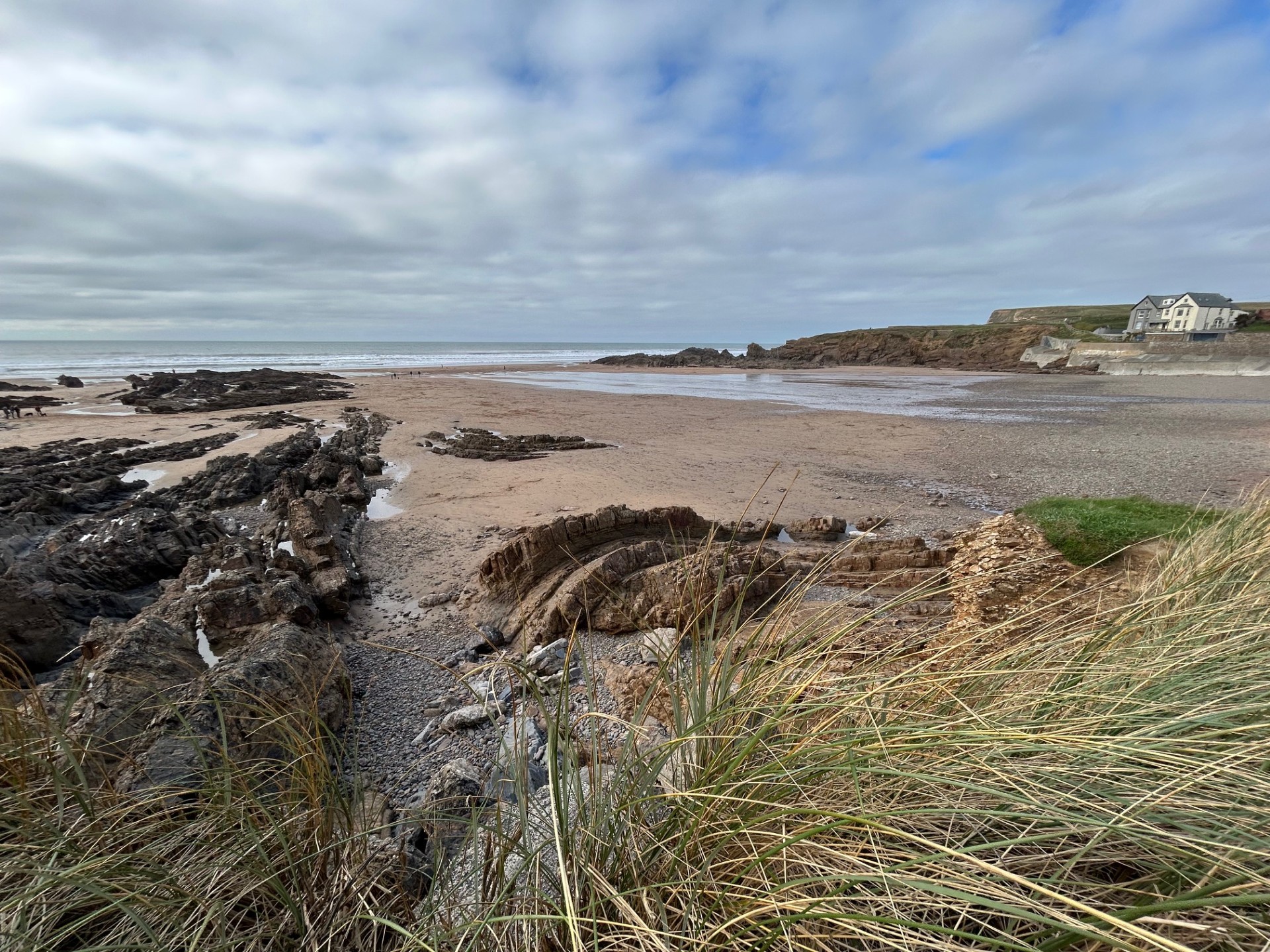
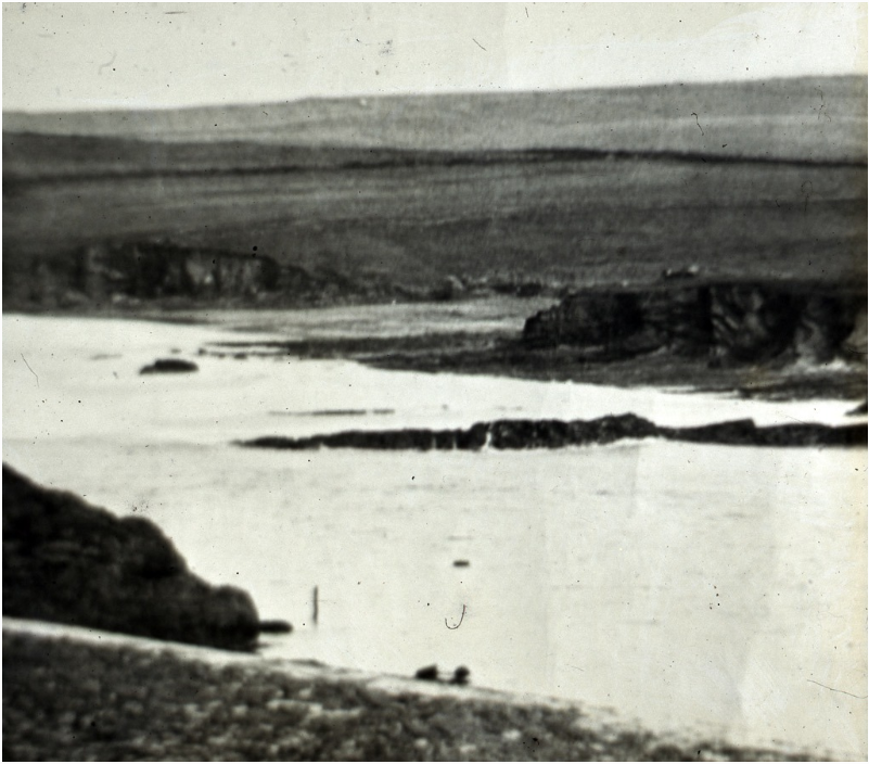
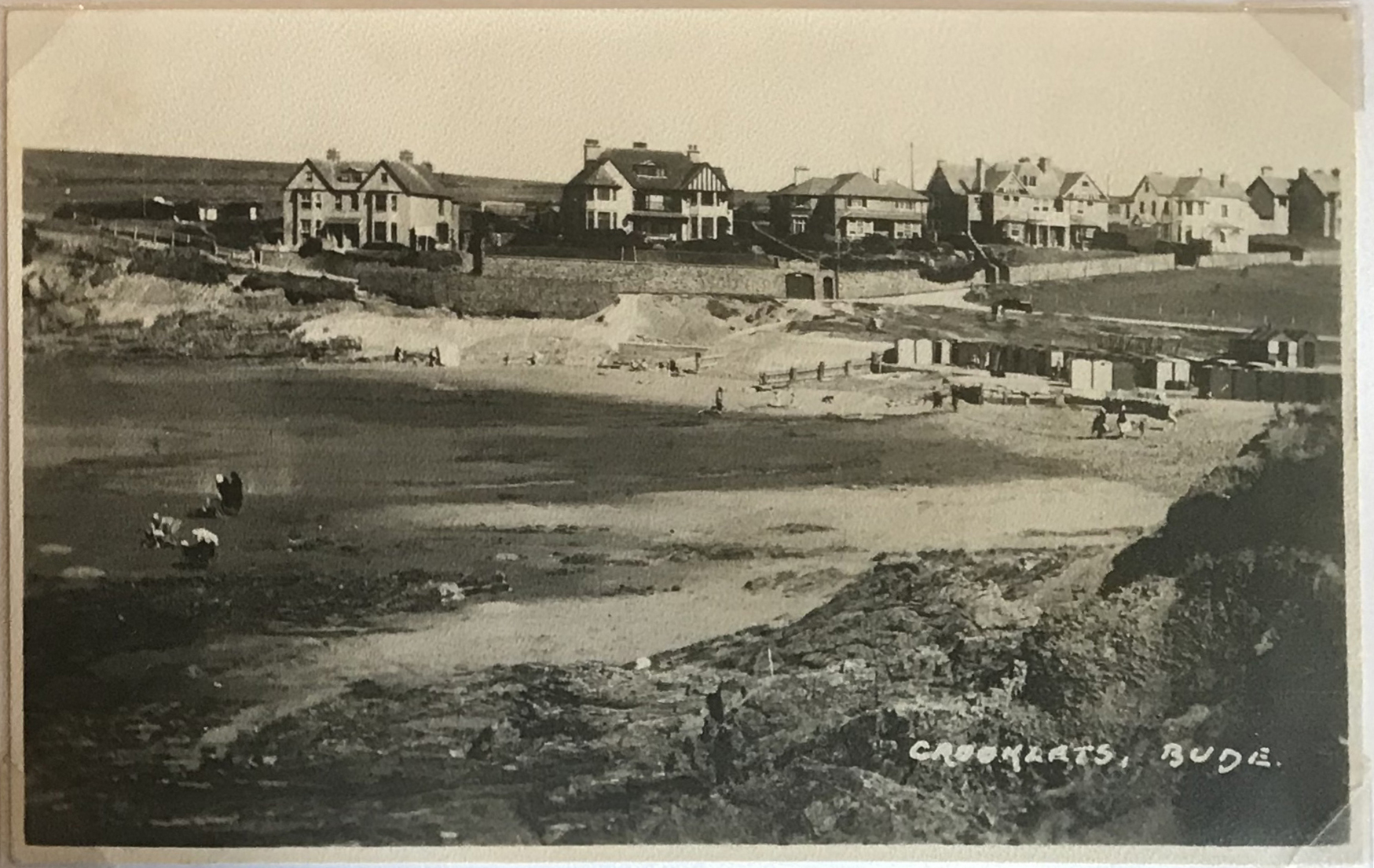
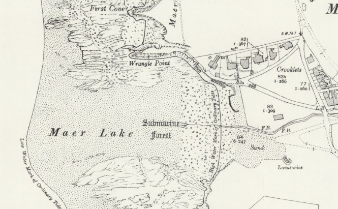
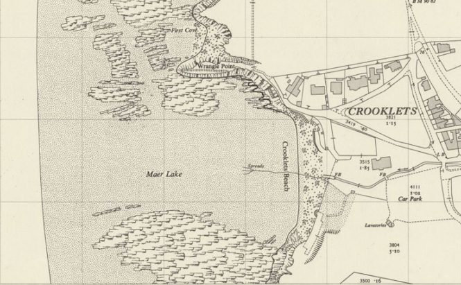
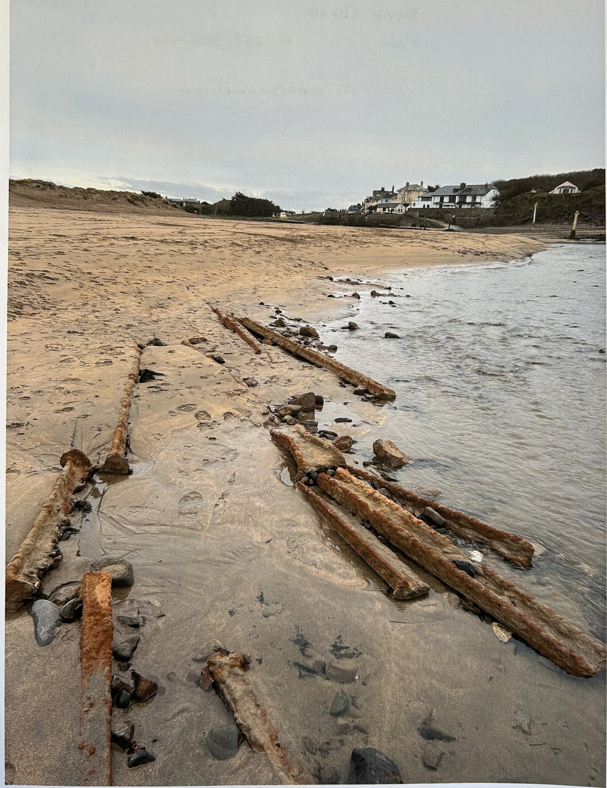
At low tide, after major storms, peat deposits and the remains of a submerged forest (around 3,000–5,000 years old) are sometimes exposed at Crooklets. These layers formed when sea levels were much lower and the shoreline lay far to the west. At the start of the Holocene, the coast was up to 30 kilometres away. As sea levels rose, woodland, wetlands and freshwater pools were gradually drowned, recording a long process of shoreline movement rather than sudden change. Alongside this environmental evidence, Mesolithic and Neolithic flint tools found around Crooklets show repeated prehistoric use of the area. These include leaf-shaped arrowheads discovered on the coastal slopes to the south of the beach, and a recorded Neolithic occupation site nearby. Together, these finds show that people returned to this place over thousands of years, adapting their activities to a coastline that was constantly shifting, rather than fixed.
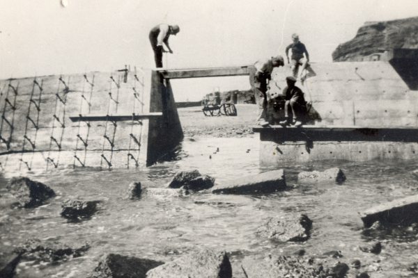
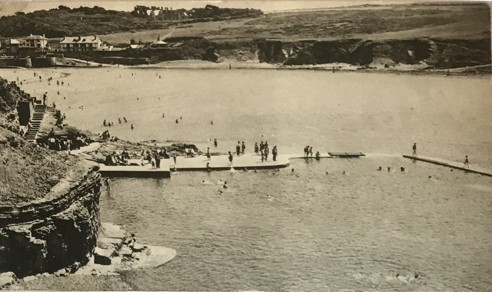
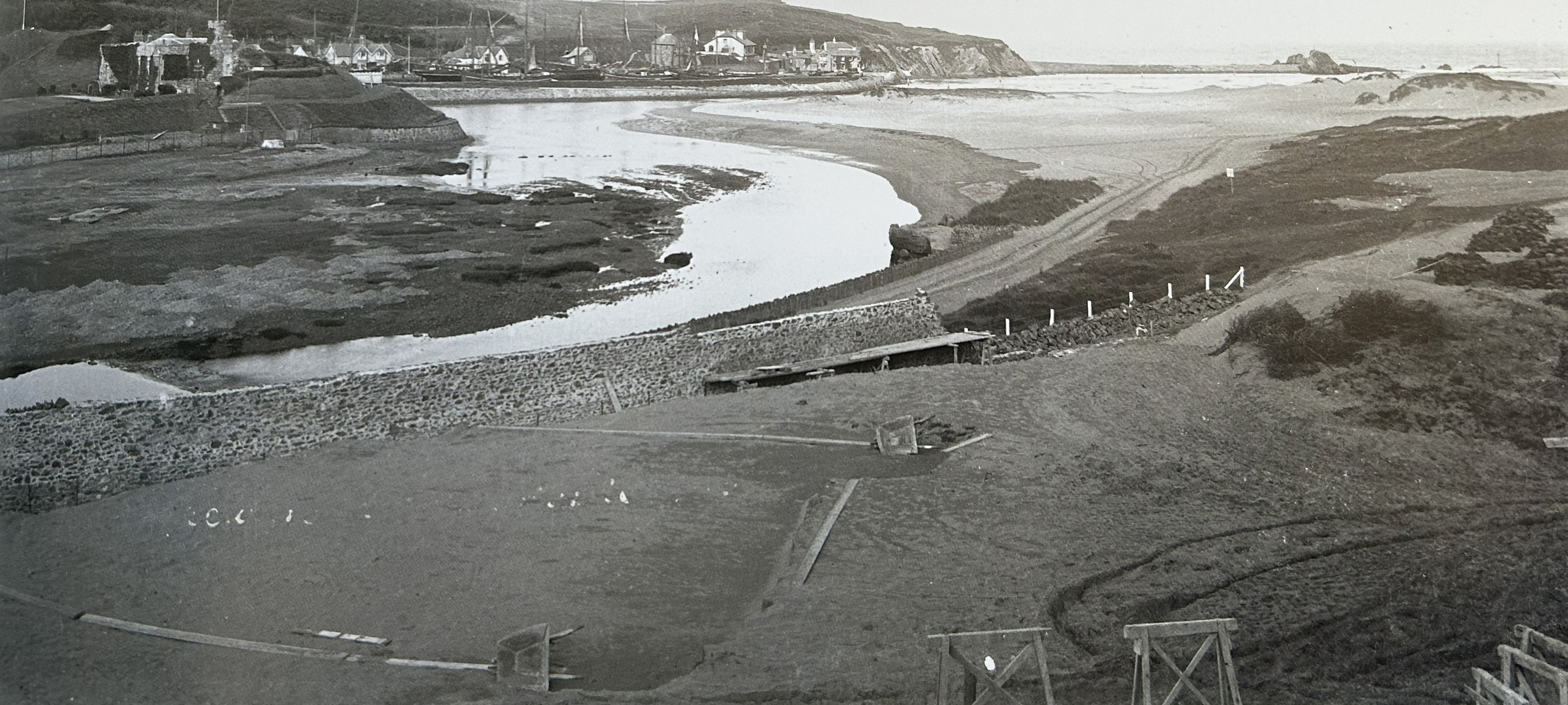
The Bude Sea Pool was built to make sea bathing safer, but it also became part of the coastline itself. For nearly a century, it has helped hold the line between the land and a restless sea.
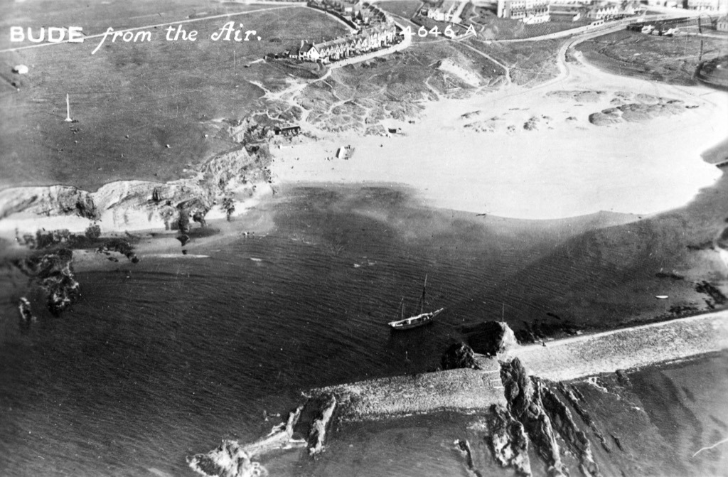
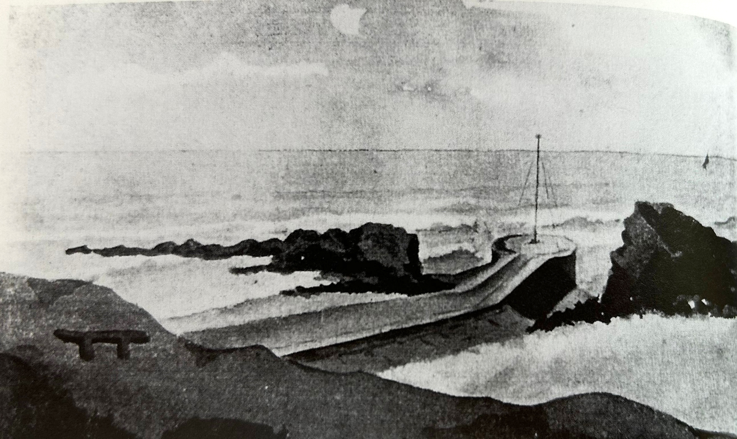
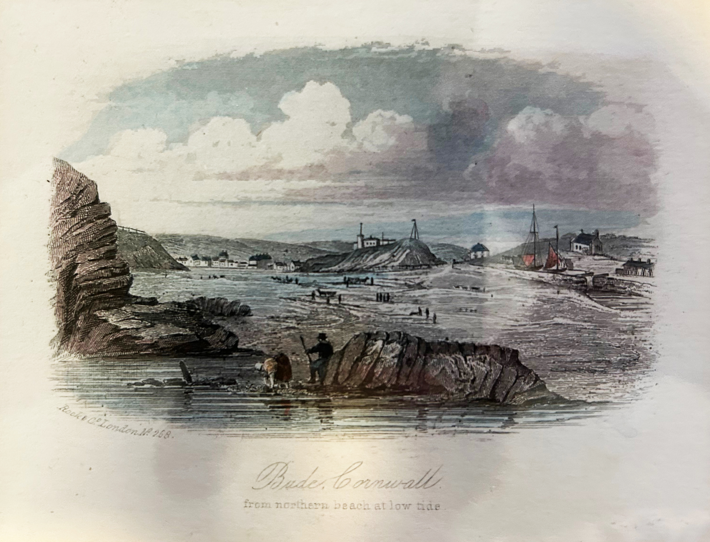
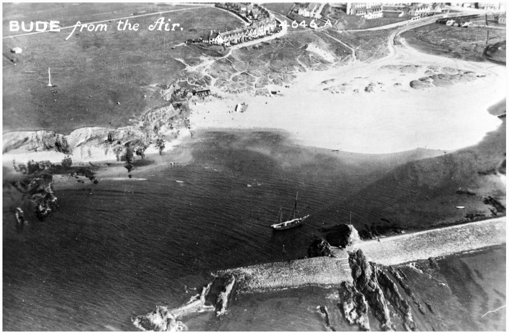
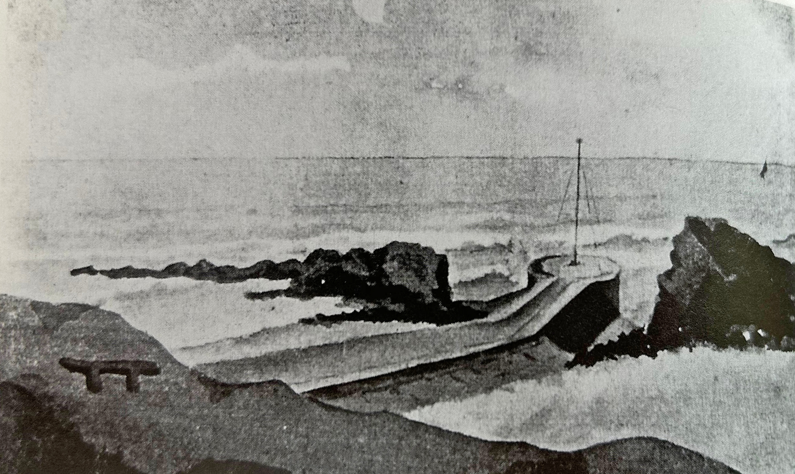
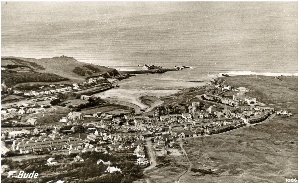
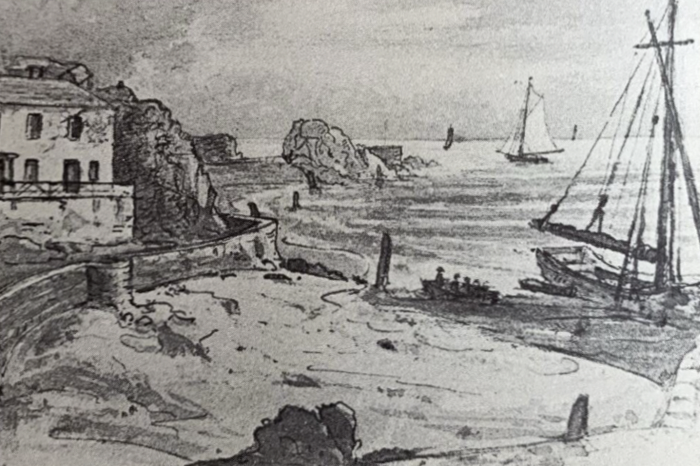
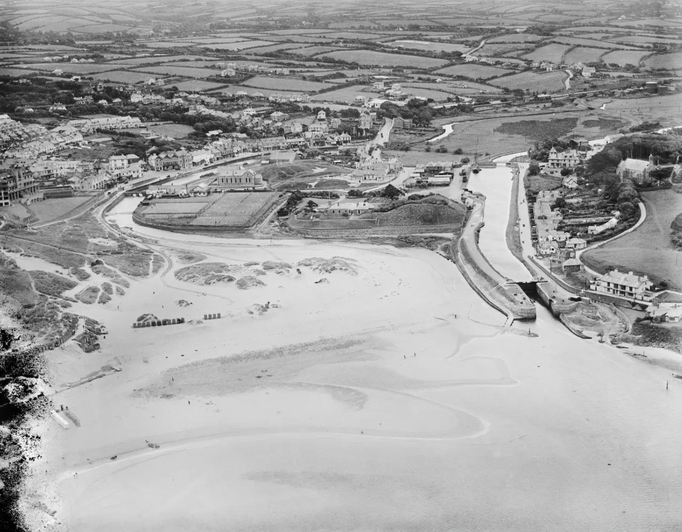
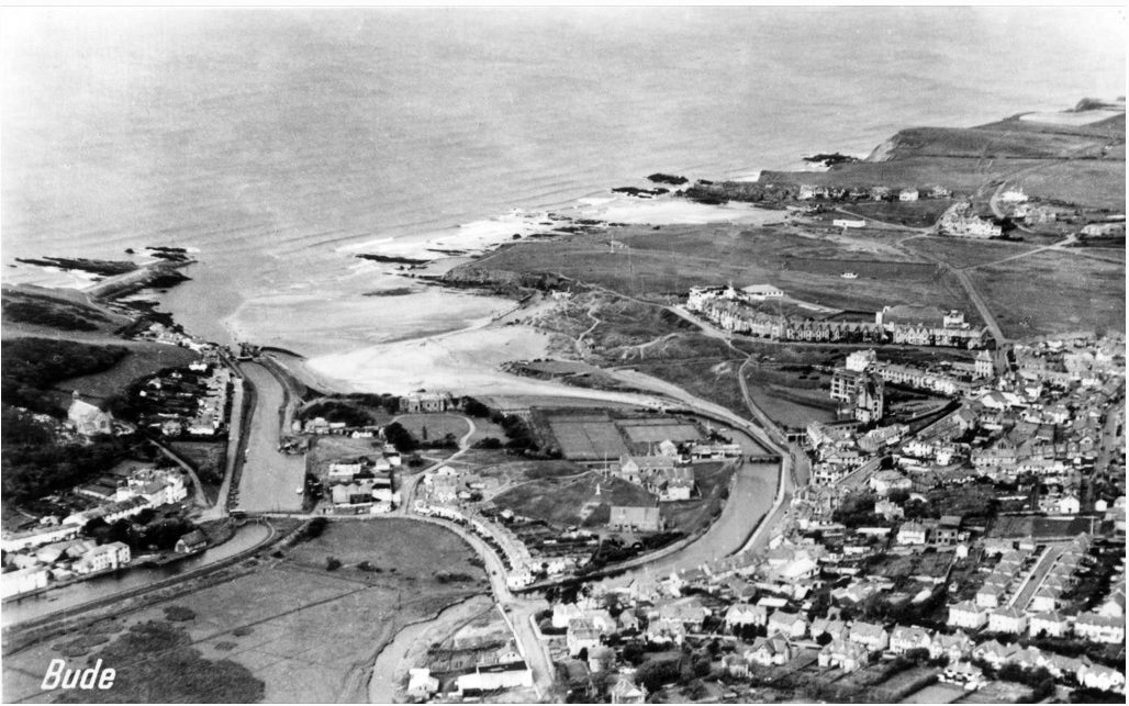
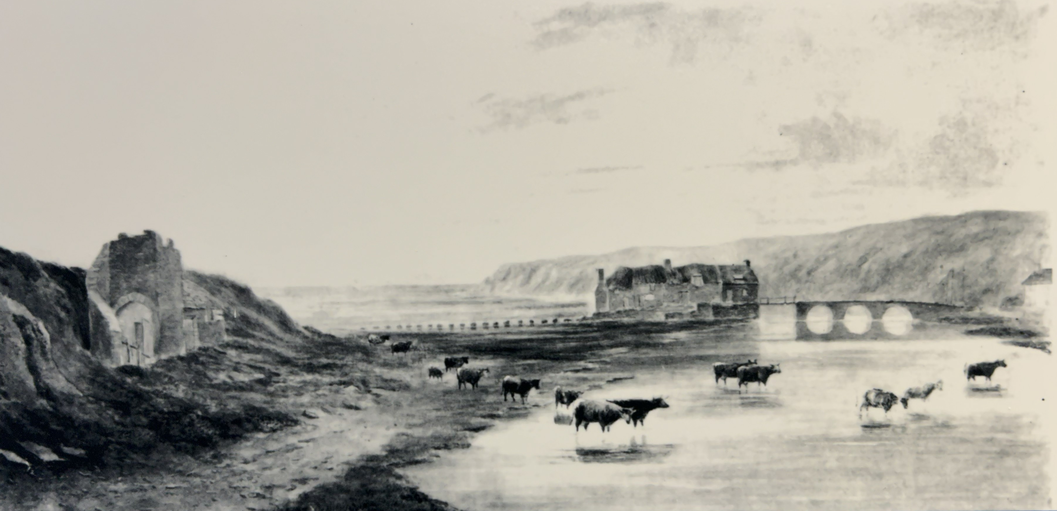
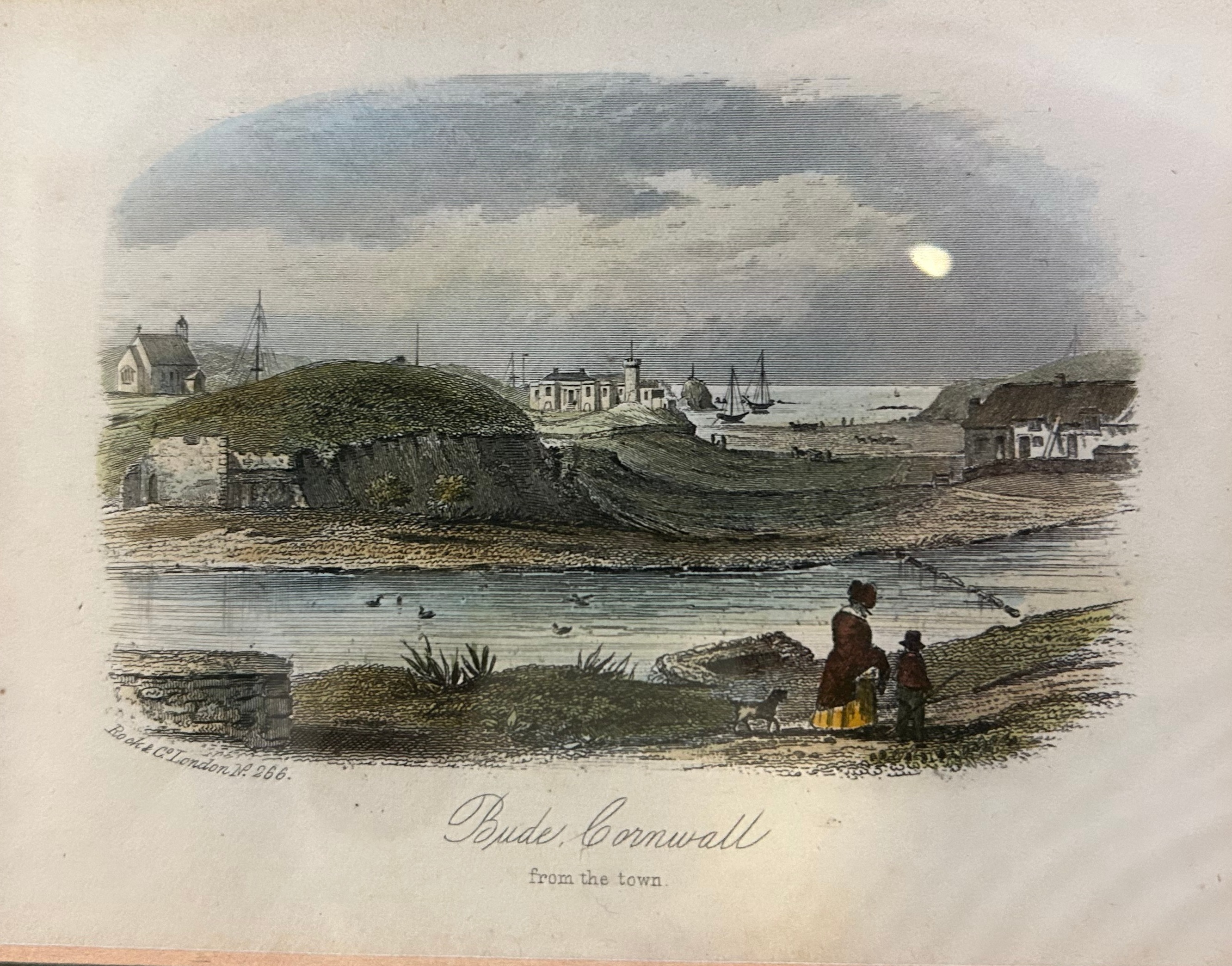
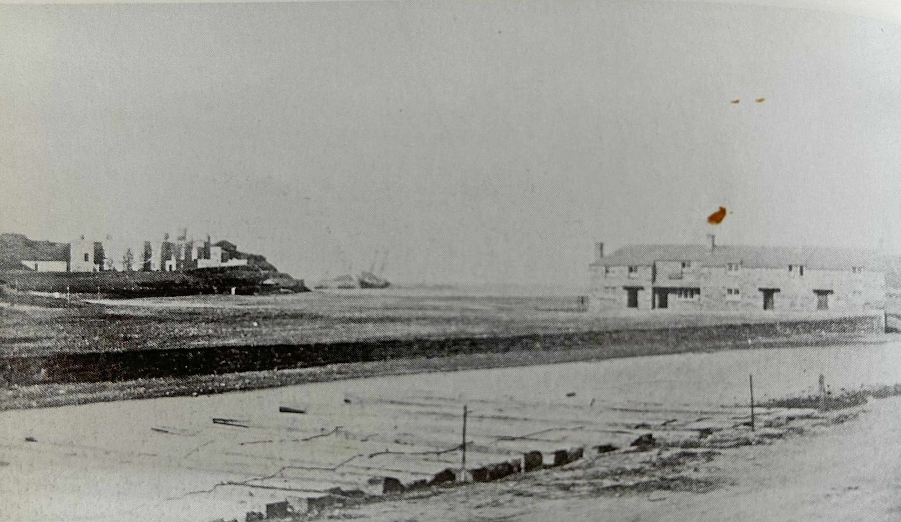
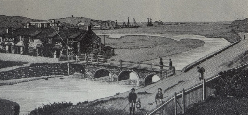
Historic artworks from the 19th century show an open, exposed coastline of cliffs, rocks and beach. These images capture the shore before the Sea Pool existed, when waves and storms reached the base of the cliffs directly. An aerial photograph taken of Bude from the air in 1922 also shows a rocky and exposed coastline.
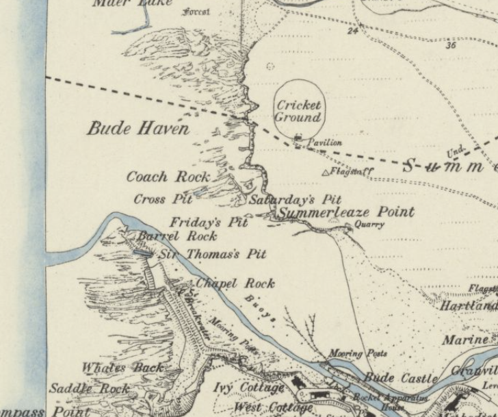
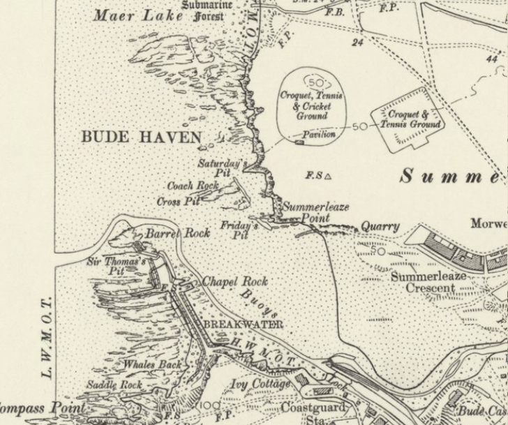
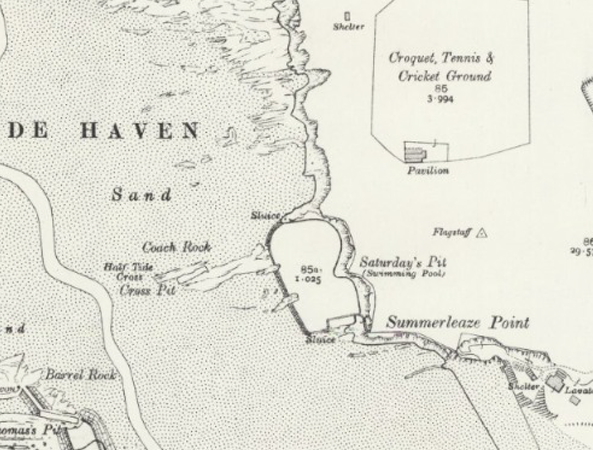
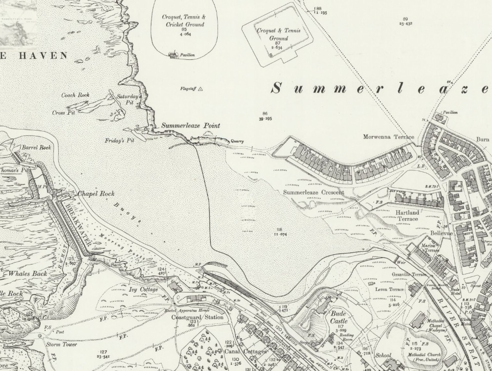
Early Ordnance Survey maps confirm this. The 1888 and 1906 maps show no protection here; the cliff edge was shaped entirely by natural processes. However, the broad shape of the cliff showed no change in the time between the maps.
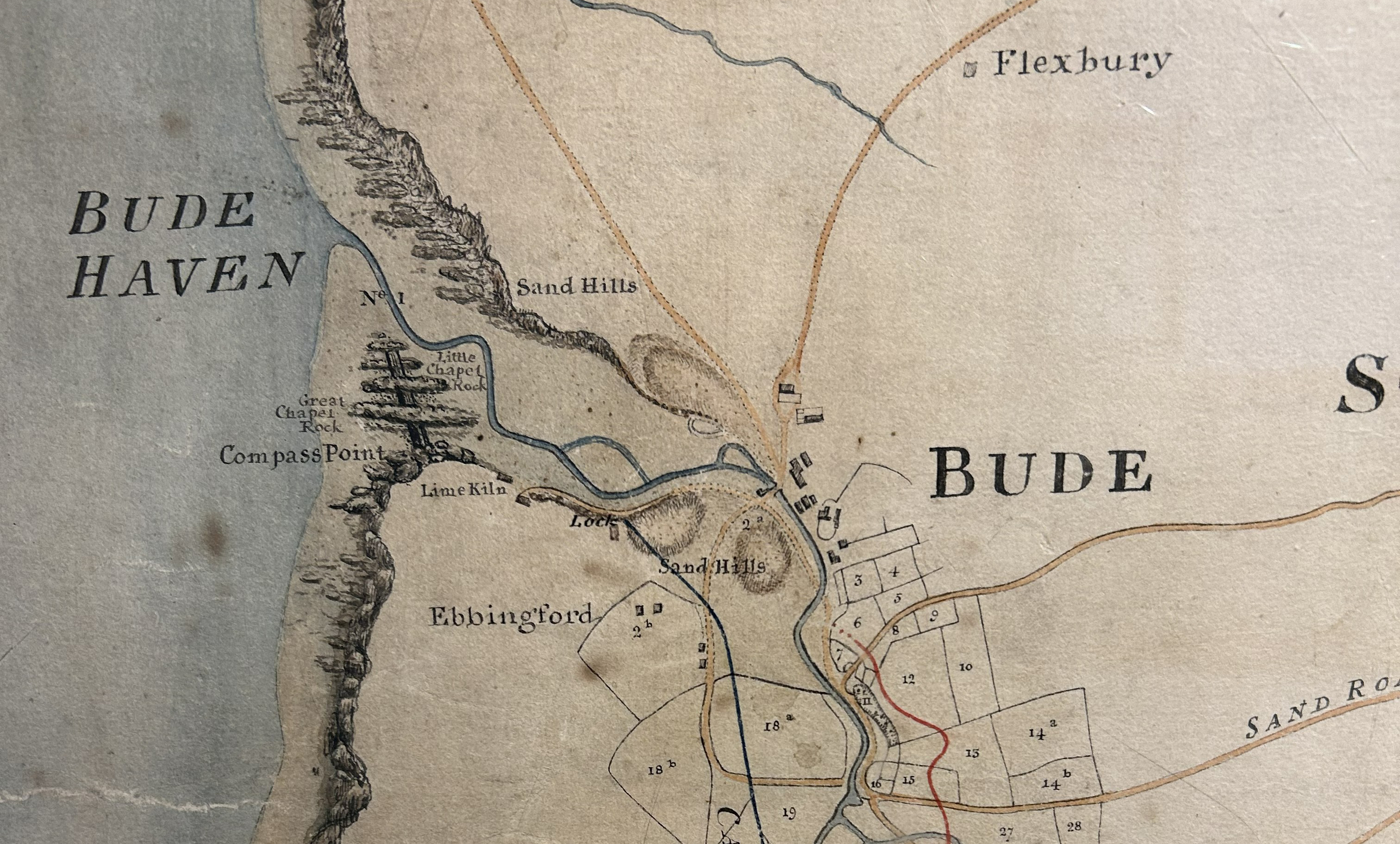
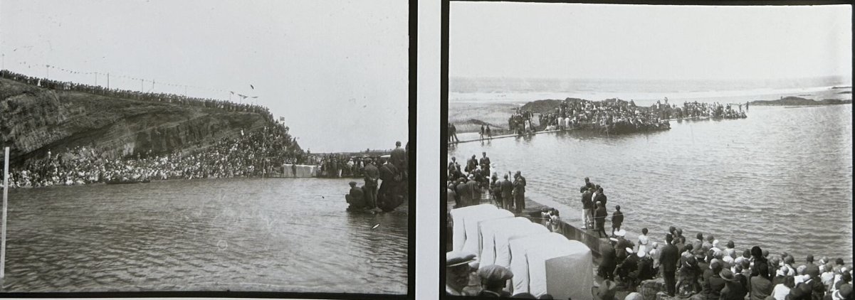
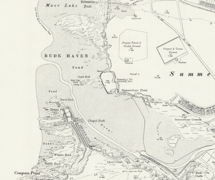
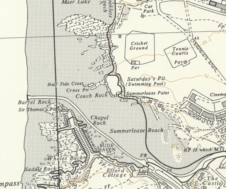
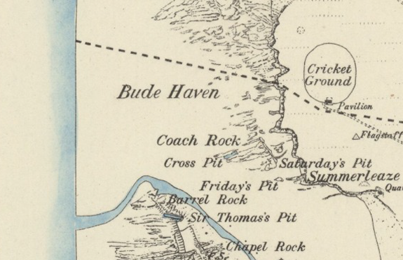
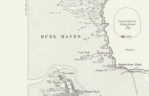
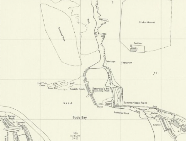
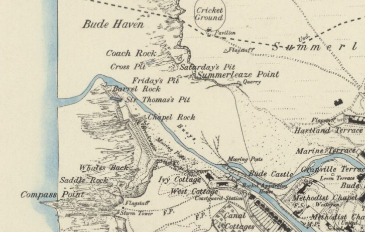
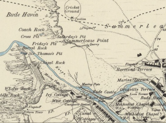
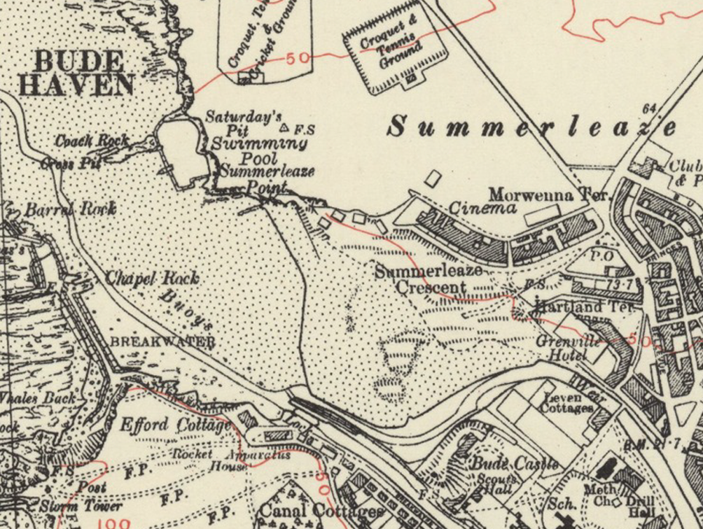
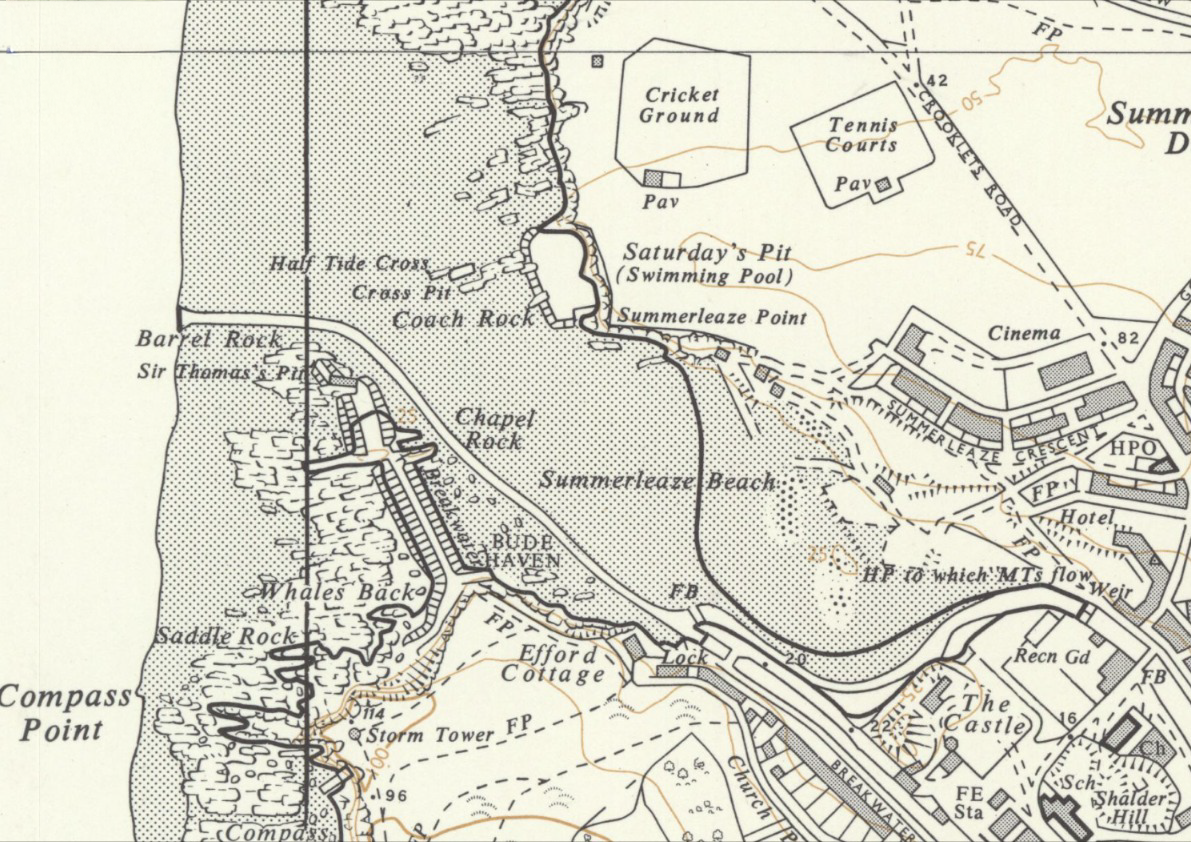
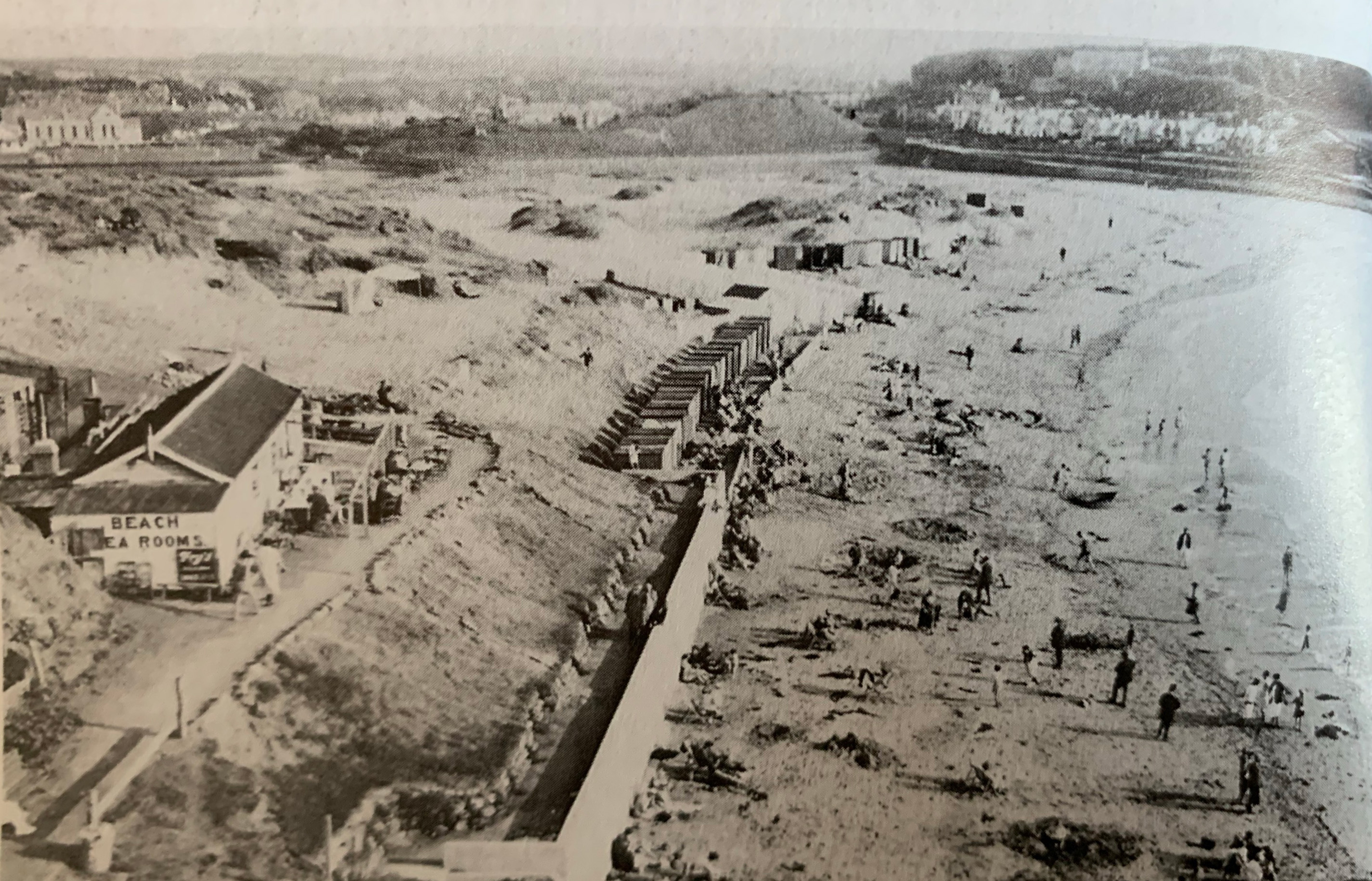
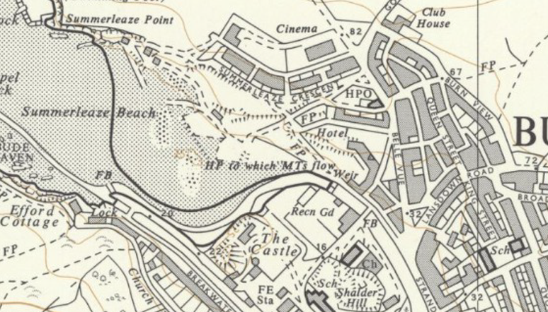
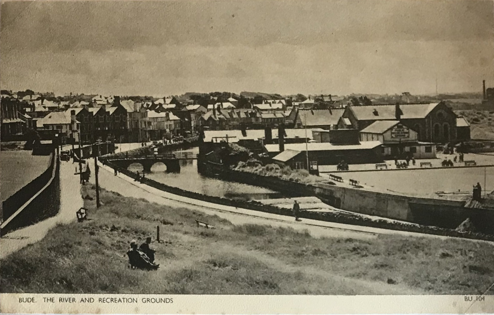
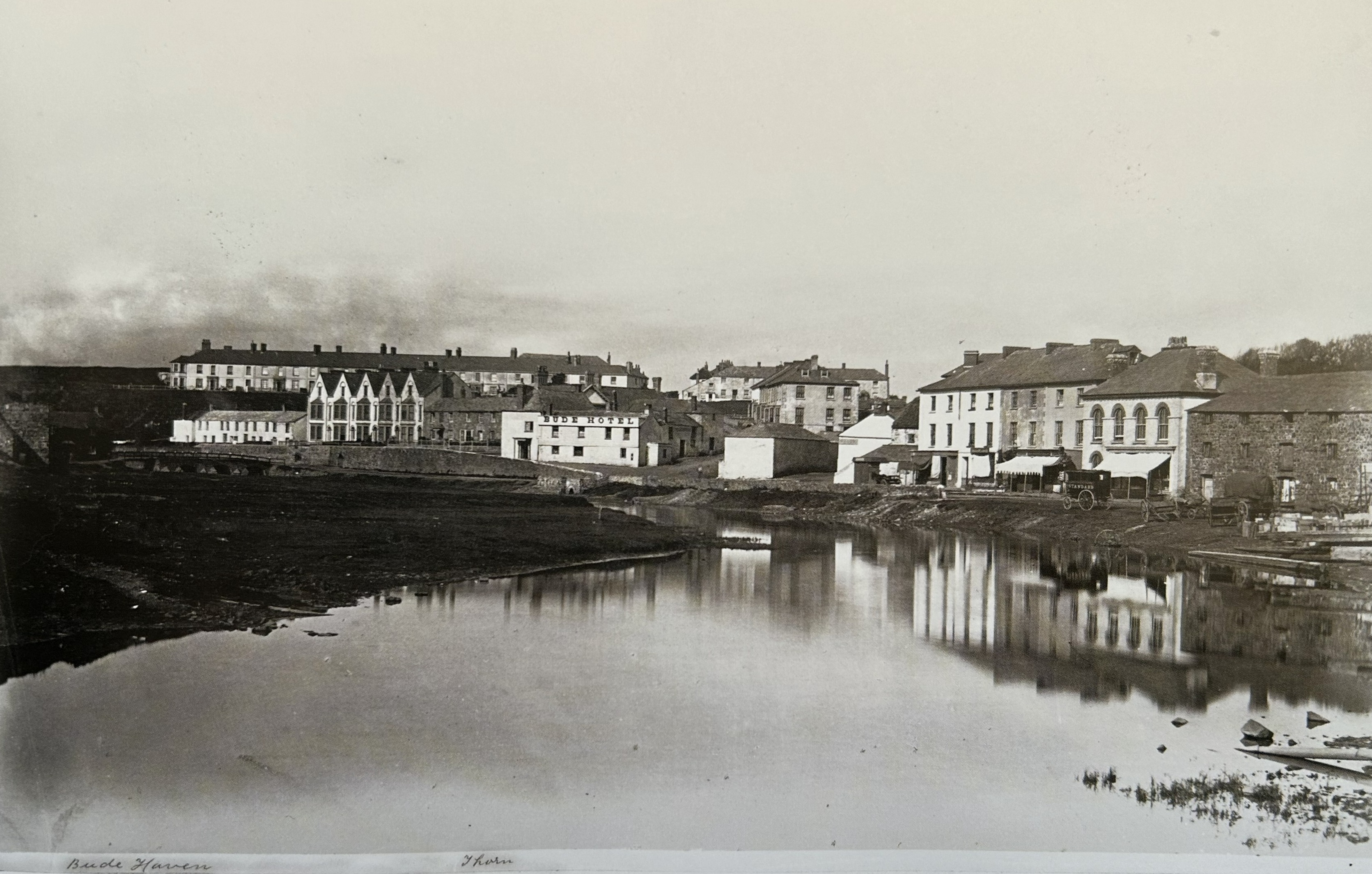
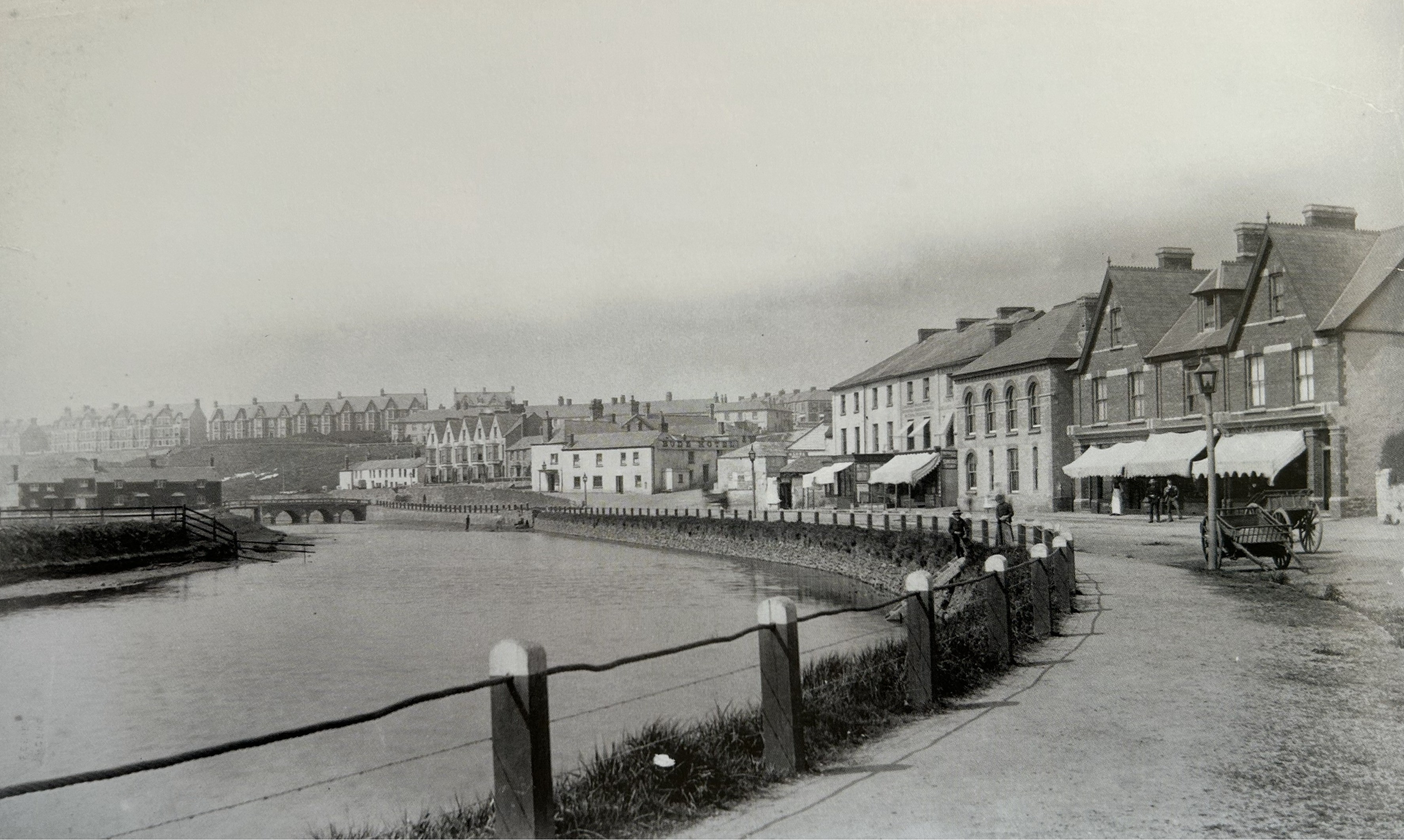
What these early maps also show is that sea bathing was already popular here well before the construction of the pool. An area labelled Saturday’s pit is visible where the current Sea Pool is now located, alongside Cross Pit and Friday’s pit. These were used as naturally sheltered bathing spots used at low tide. The pits are mentioned in a newspaper article dating to 1891 in the Cornish and Devon Post, which describes the “bathing pools known by the Bude boys as ‘Fridays pit’, ‘Saturdays pit’ and ‘Cross Pit’.”
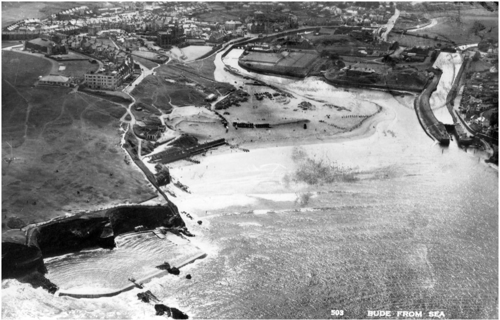
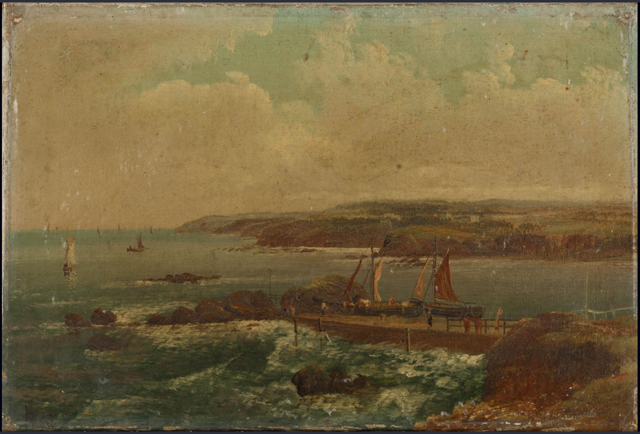
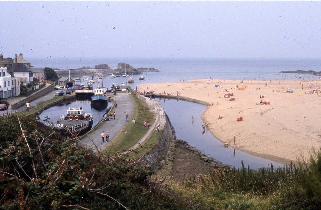
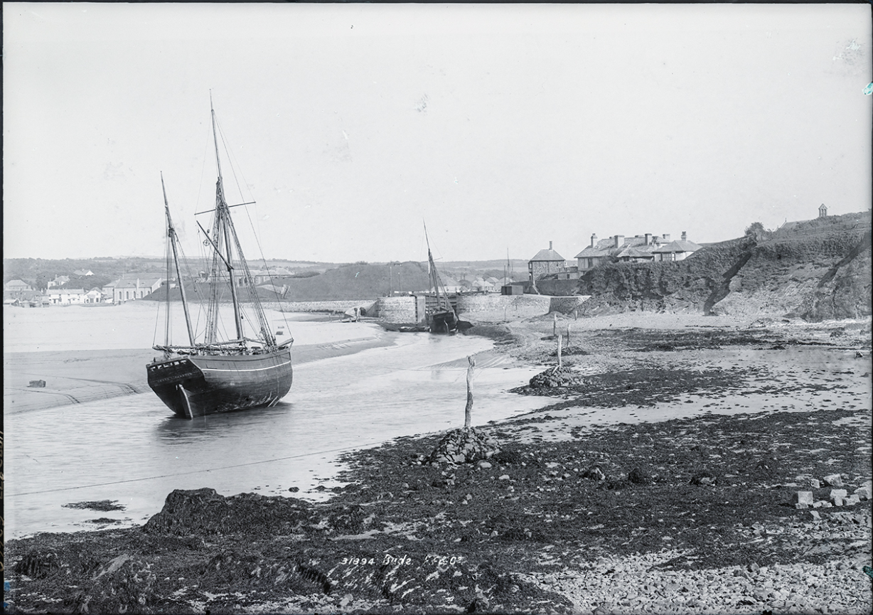
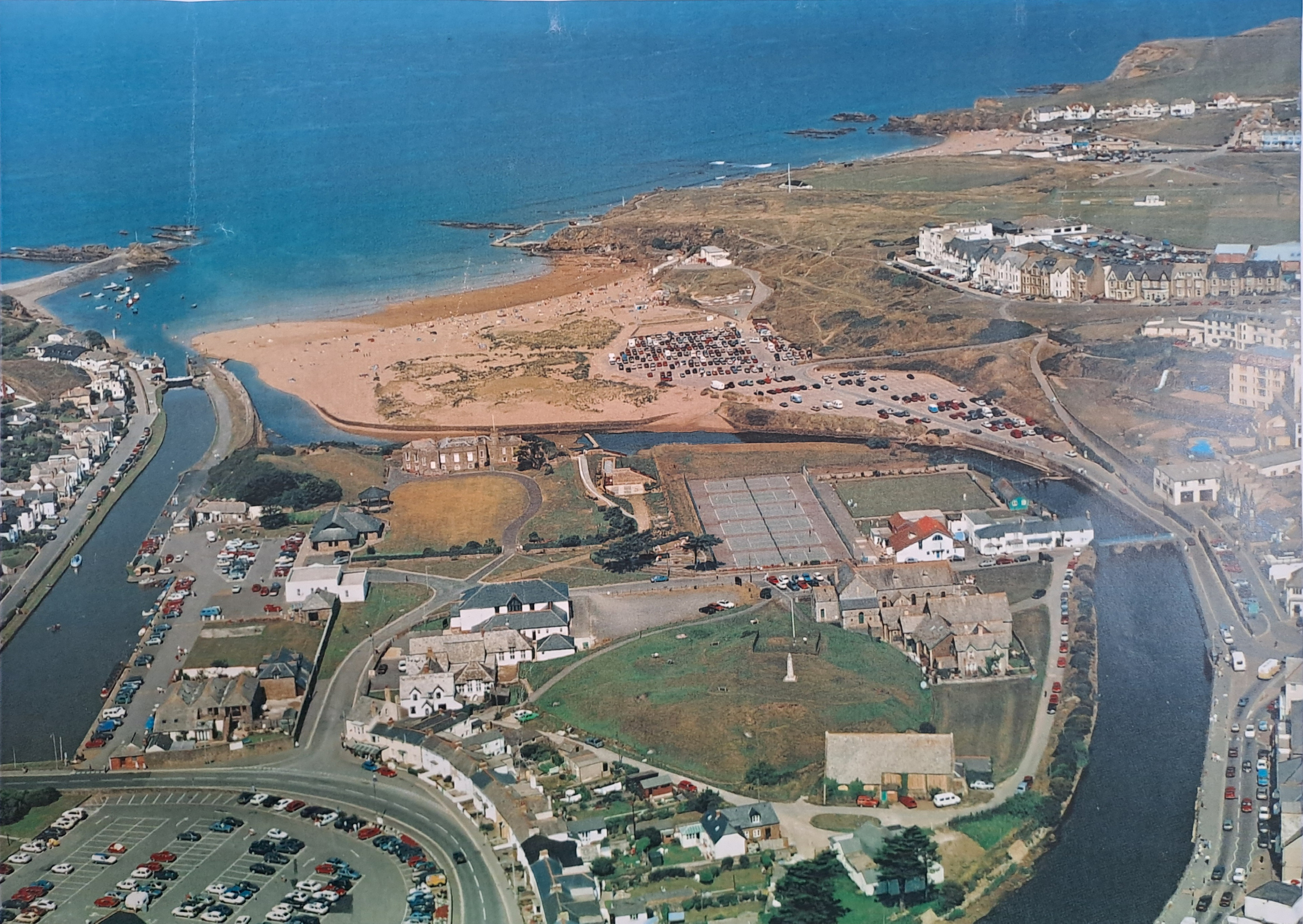
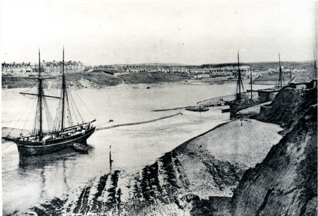
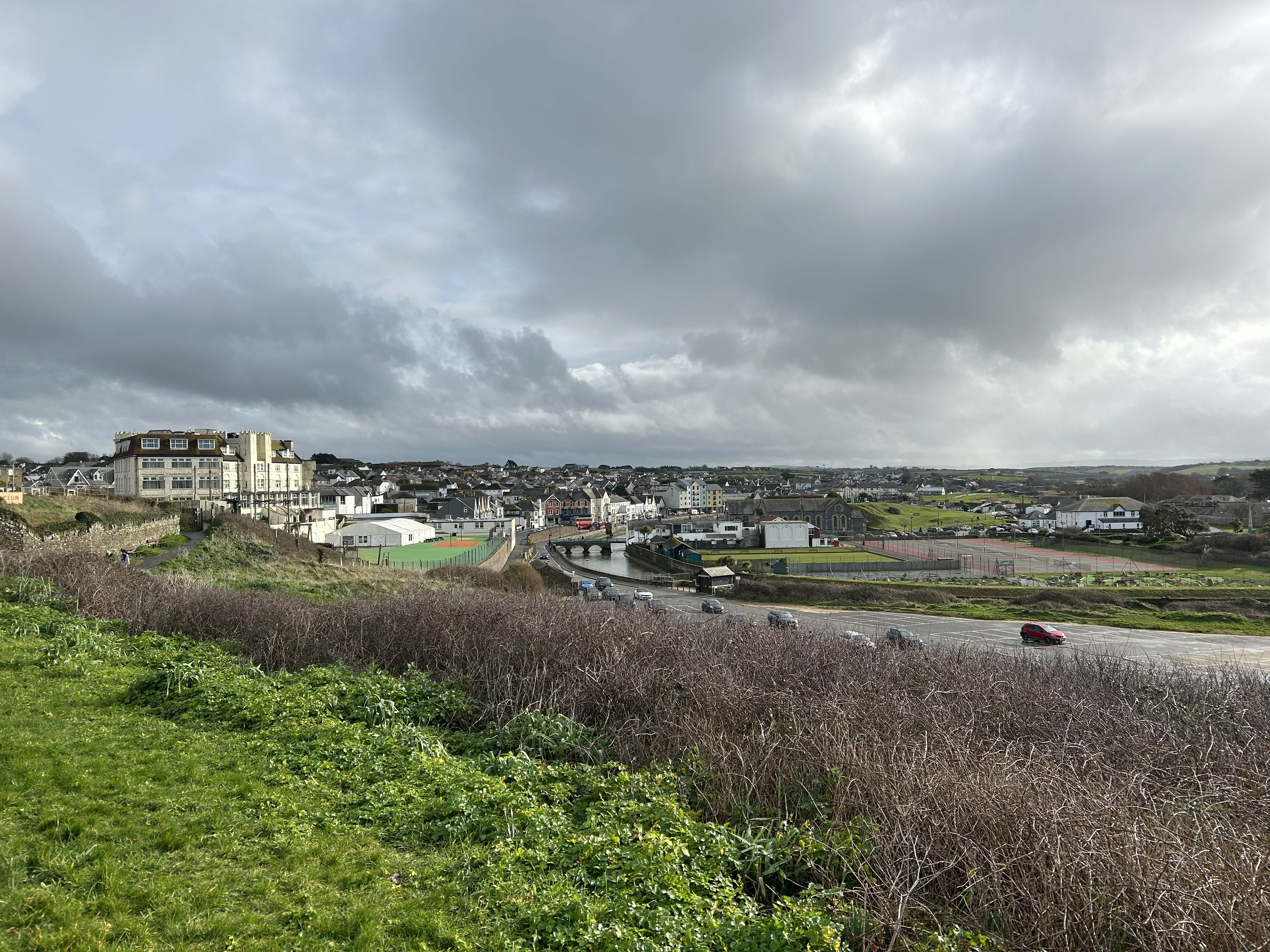
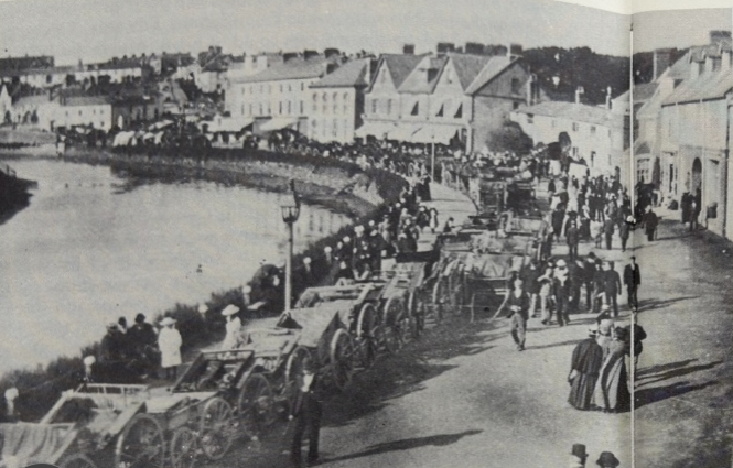
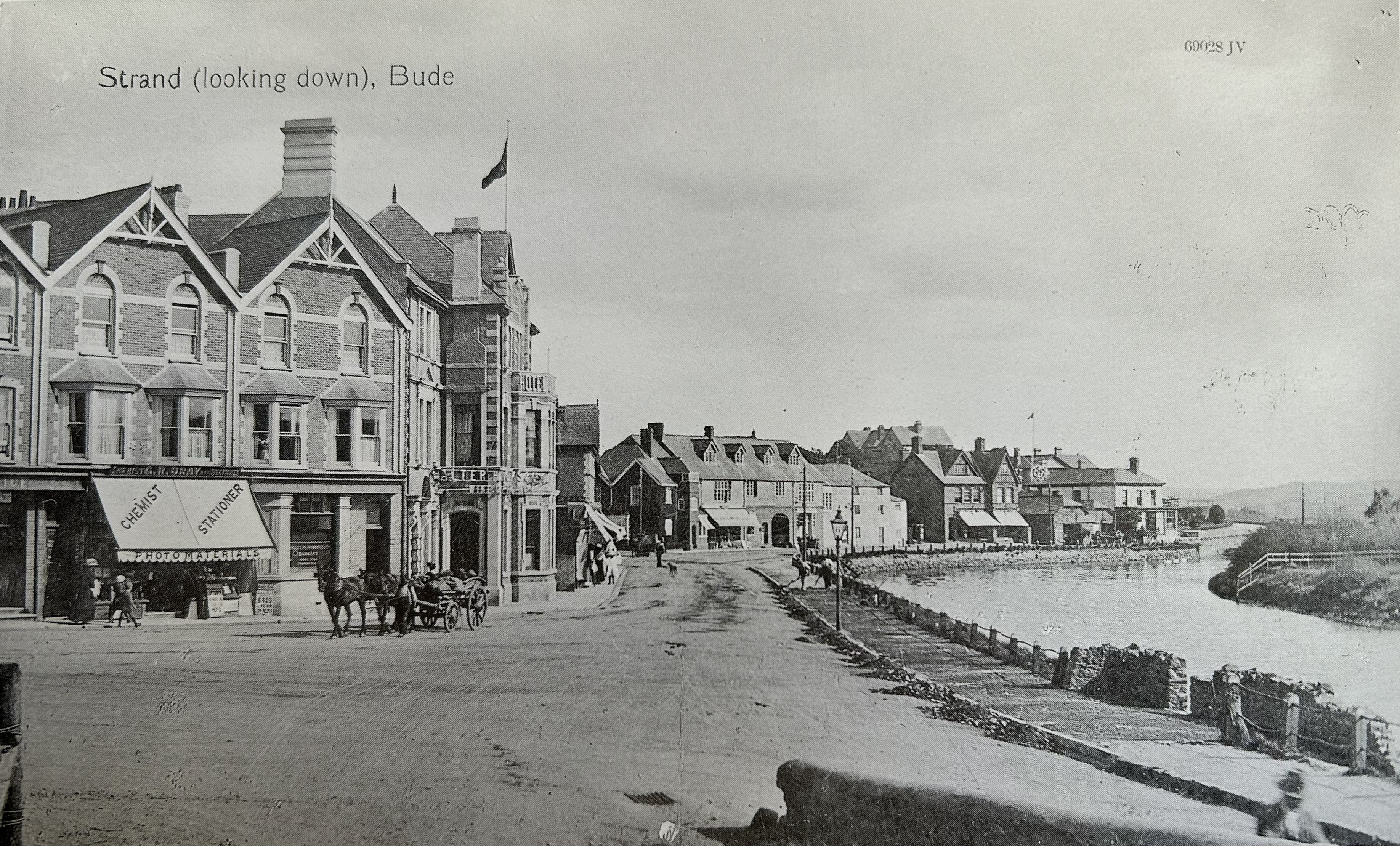
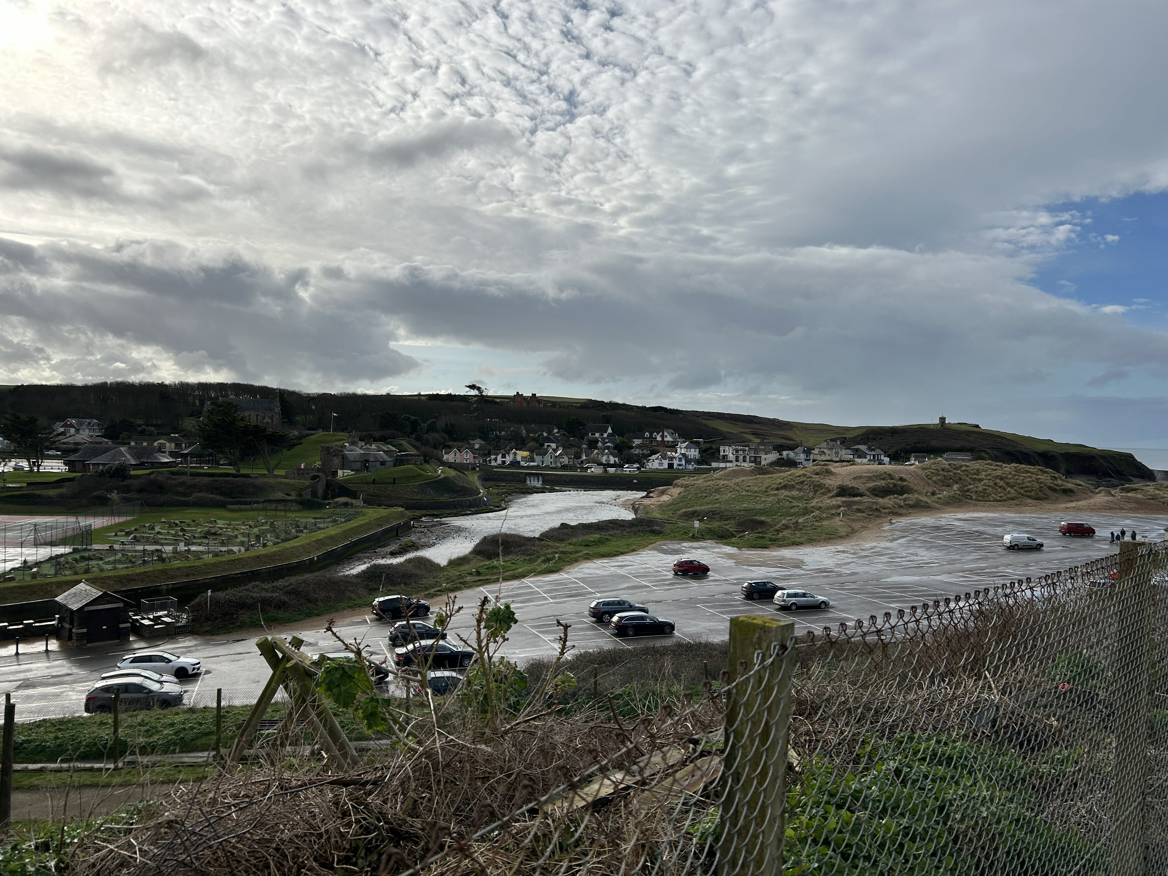
The Breakwater has created a more sheltered and stable environment for the beach, reducing wave energy and protecting the coastline from erosion. It has also provided a safe haven for boats and a place for recreational activities.
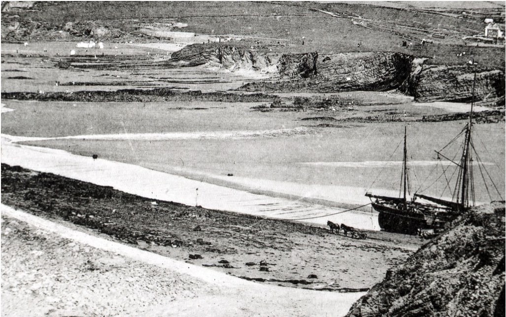
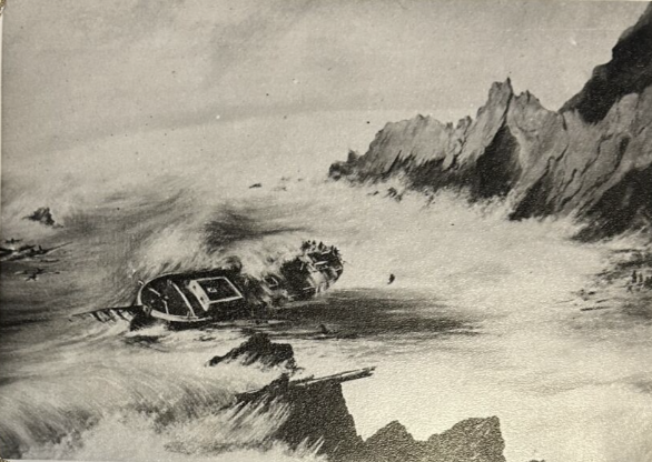
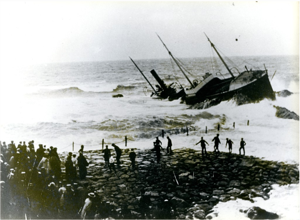
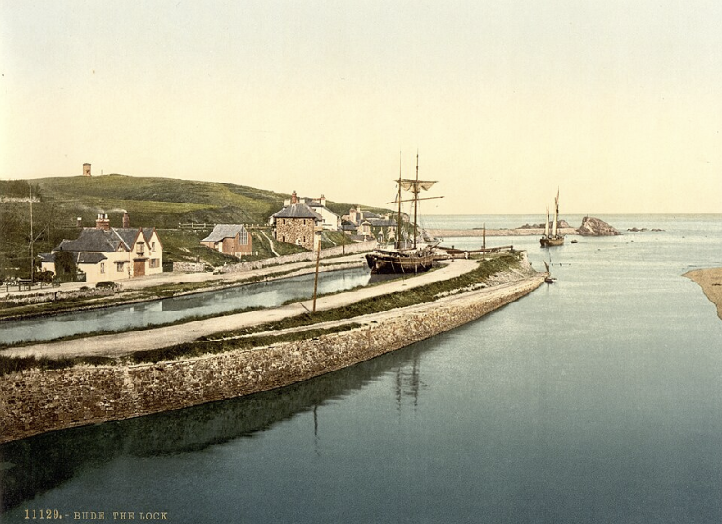
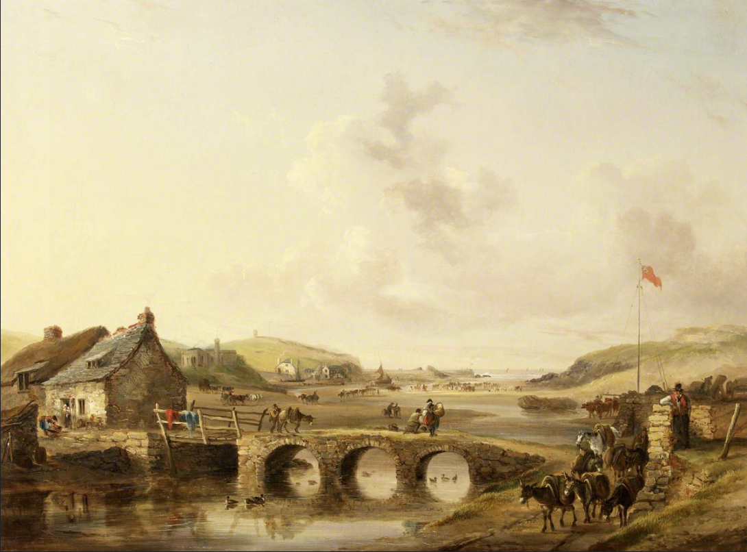
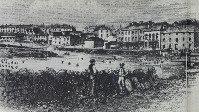
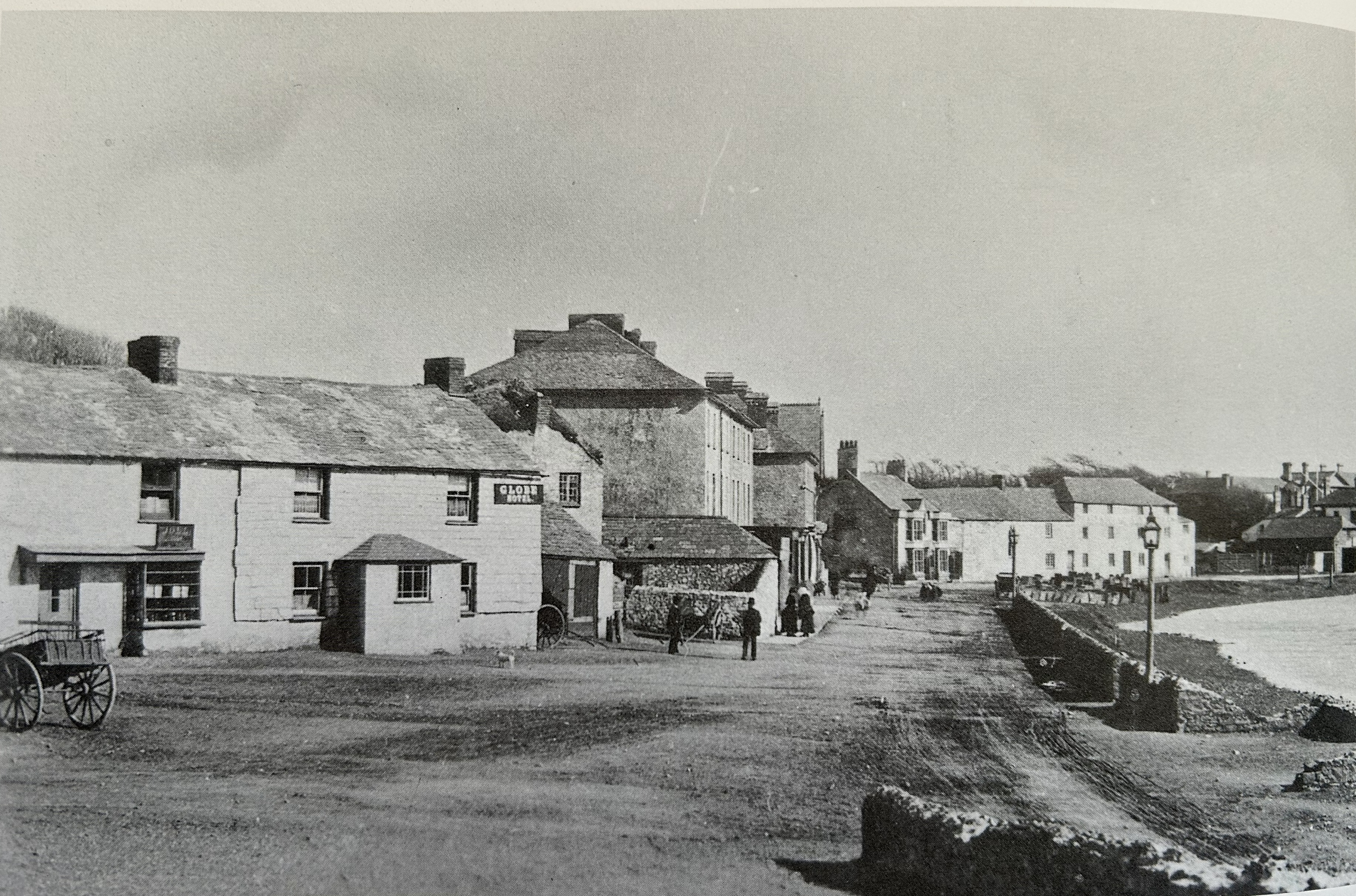
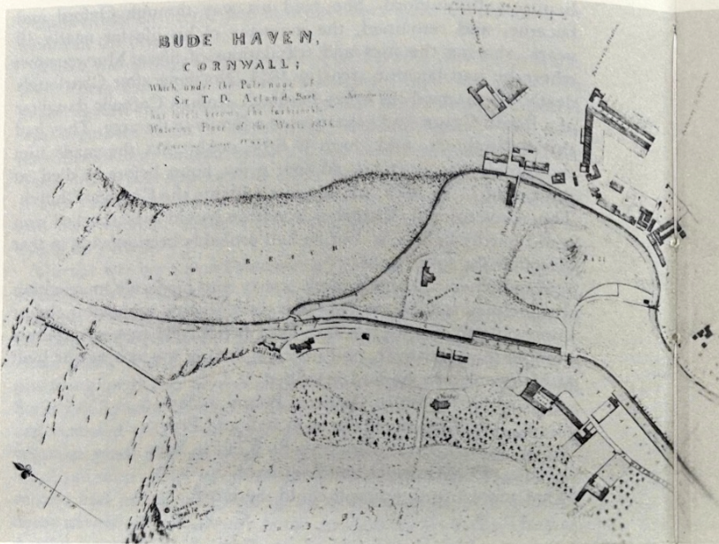
Before the 19th century, this was an exposed and hazardous stretch of coast, as attested by the large numbers of shipwrecks on these shores. Waves and strong tidal currents swept directly into the mouth of the haven, making safe anchorage difficult and unreliable. Chapel Rock stood offshore, topped by a small chapel that served as a landmark for sailors, but offered no protection to ships from the sea. Sand, shingle and rock were moved freely by waves and tides, and the shape of the shoreline changed constantly. There was little thought at this time about flood risk or coastal protection. The coast was expected to be dynamic, and communities adapted to its changes rather than attempting to control them.
Click below to explore how the Lockhead has gone from natural feature to feat of engineering that has shaped the coast.
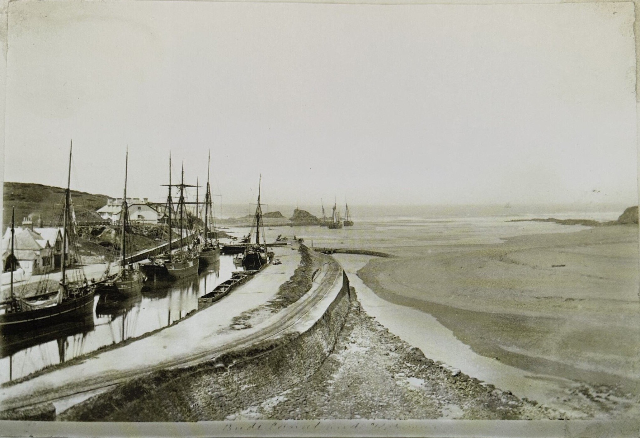
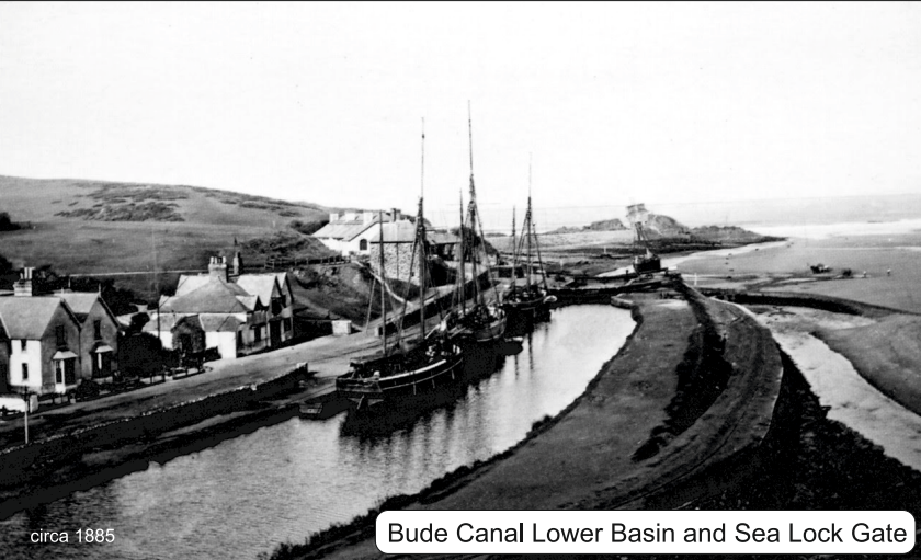
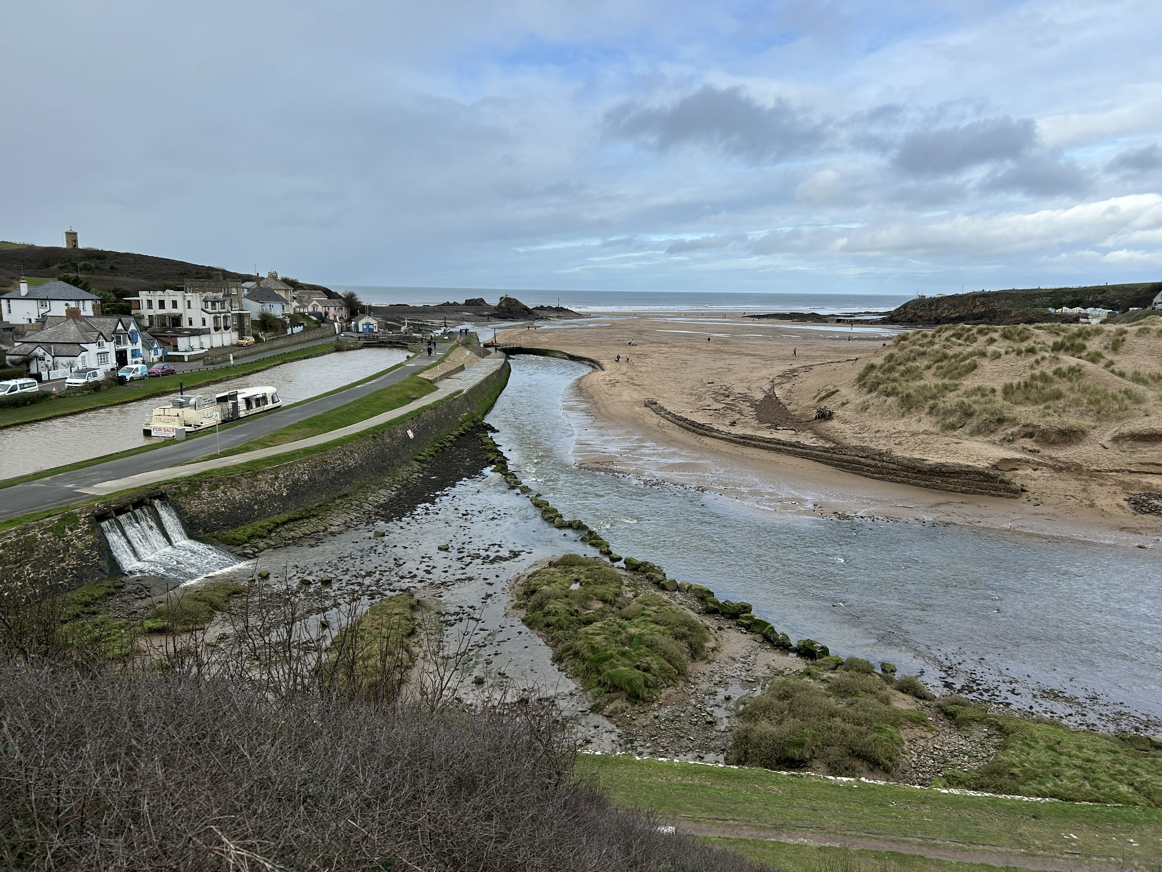
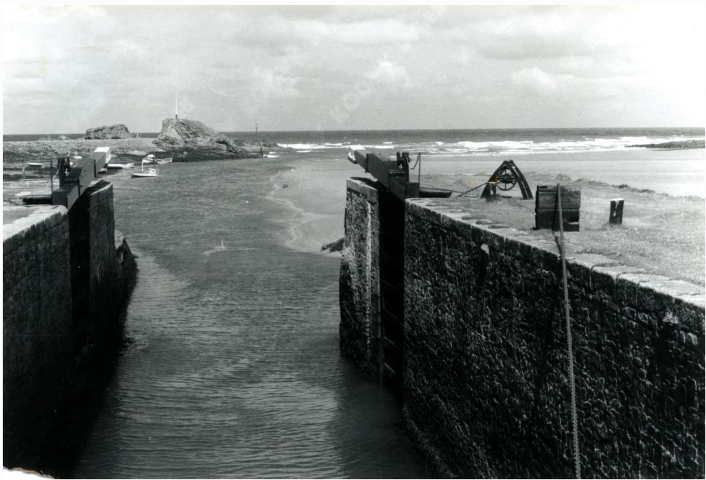
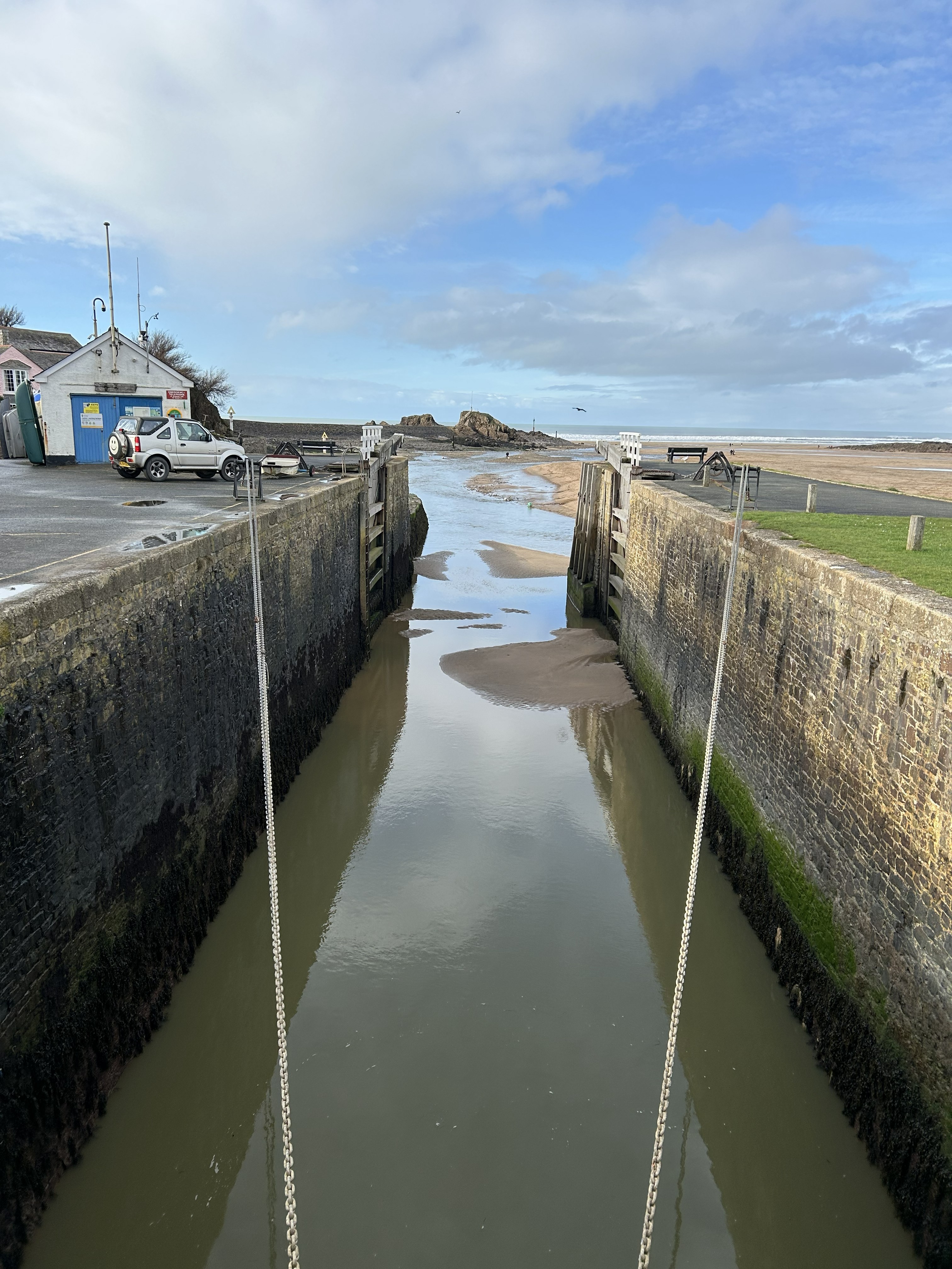
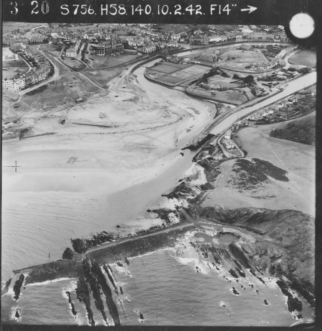
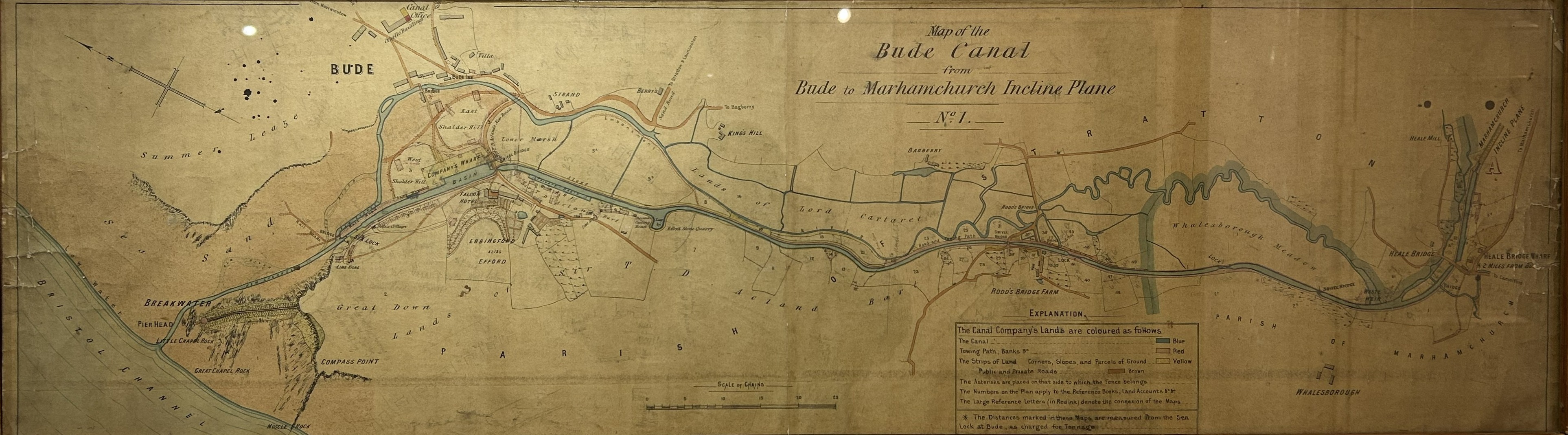
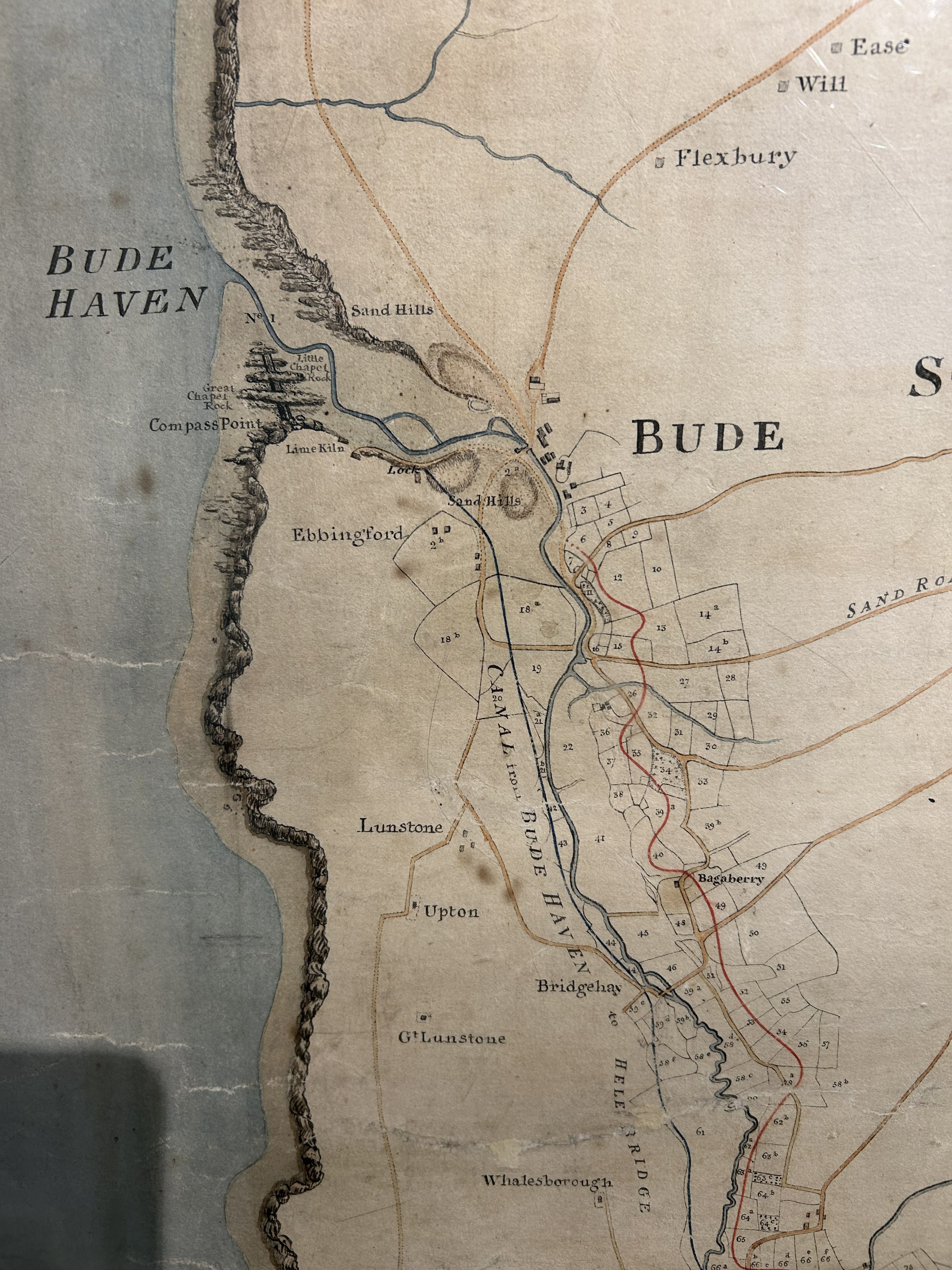
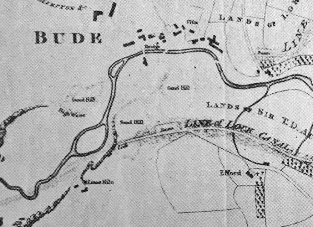
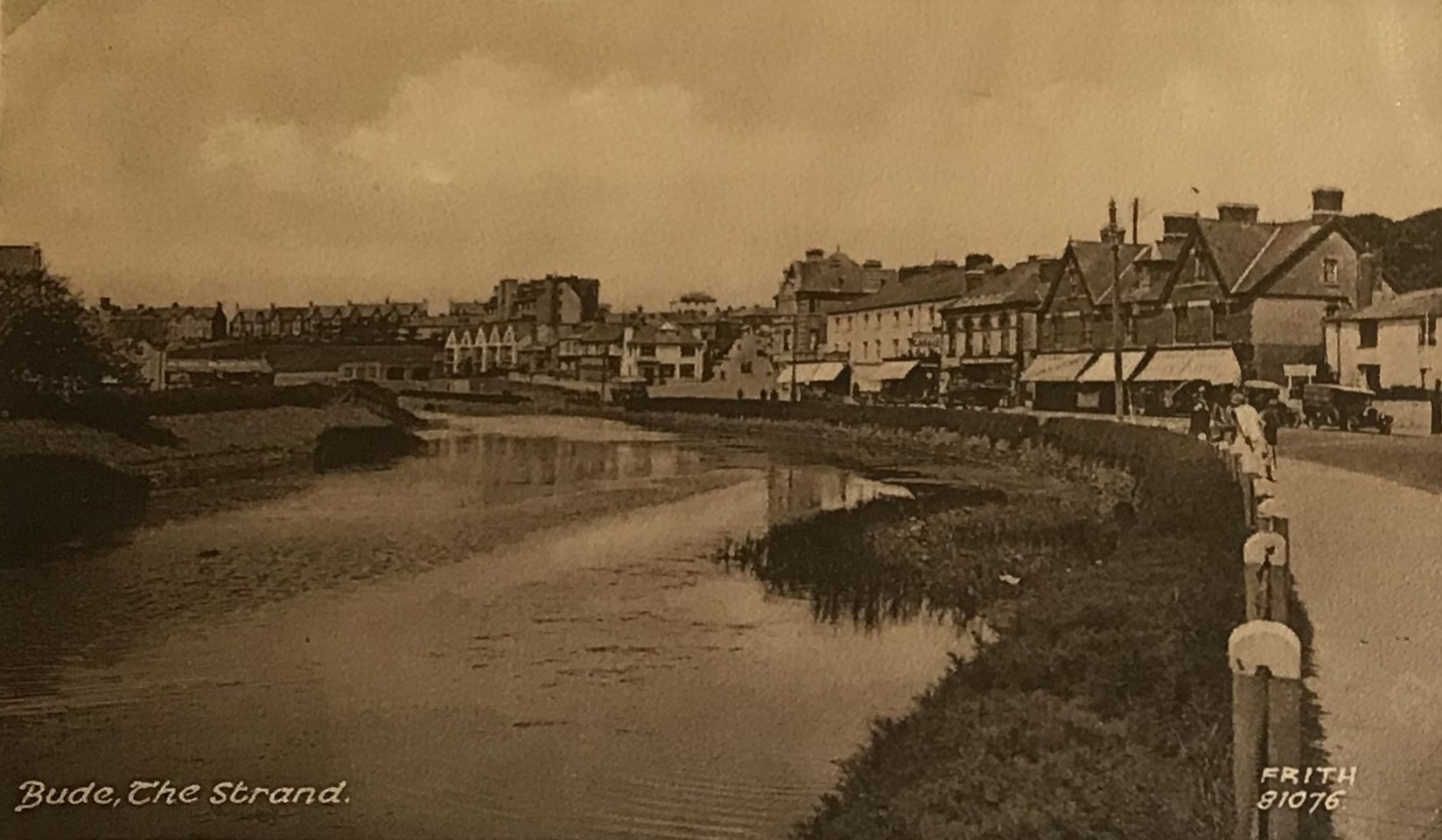
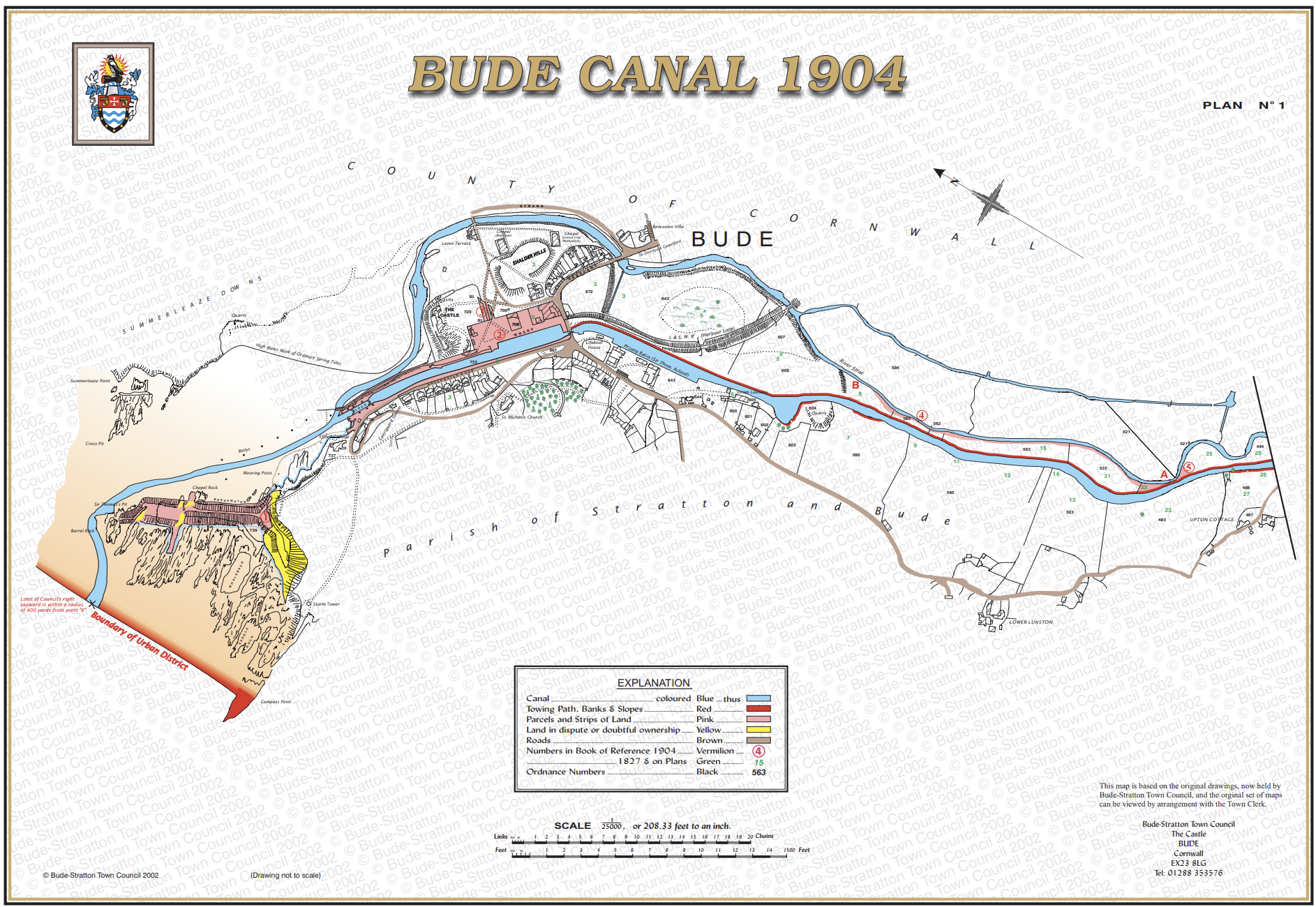
Before the canal and sea lock were built, the River Neet entered the coast through a shifting, tidally influenced channel. Its position changed in response to storms, sediment movement and river flow. Access across the river mouth was informal and variable, and the edge of Summerleaze was not fixed in the way we see today. This was a dynamic meeting point between river, beach and sea, shaped entirely by natural processes.
A living system forming an effective natural defence against flooding.
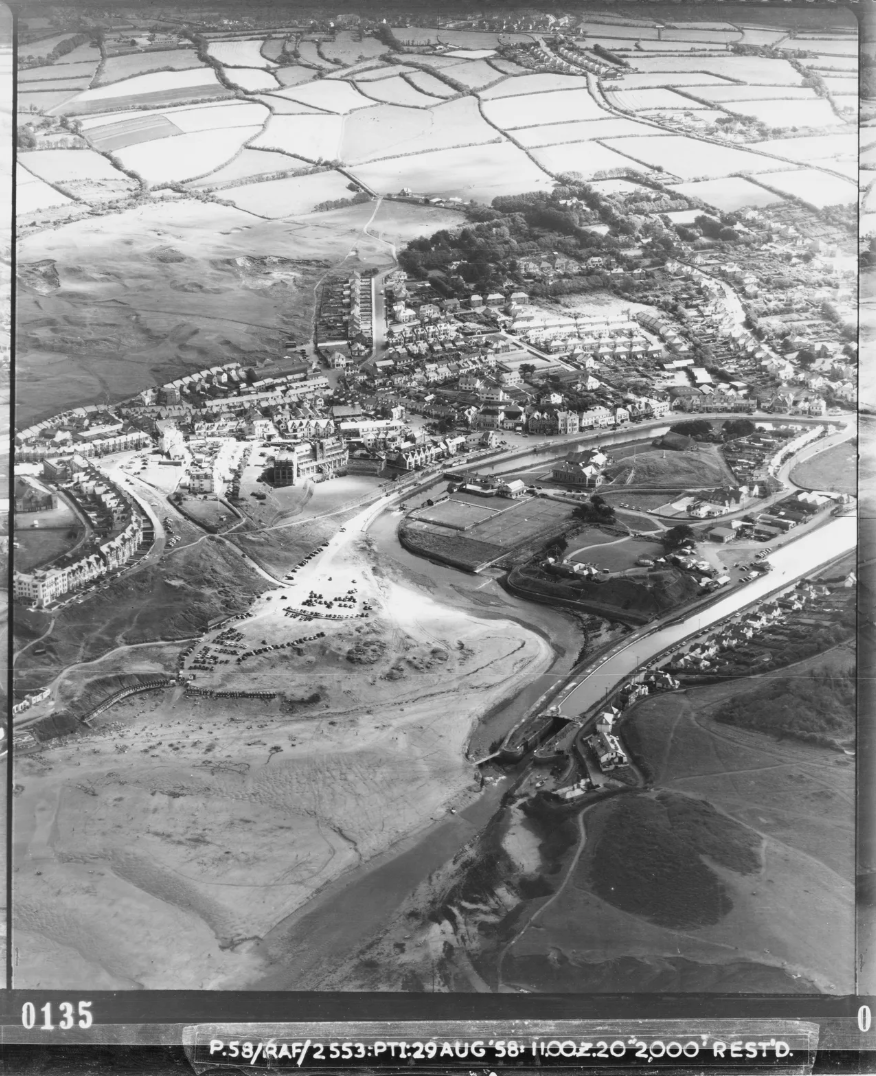
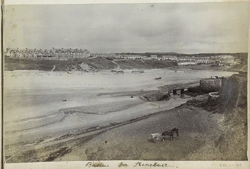
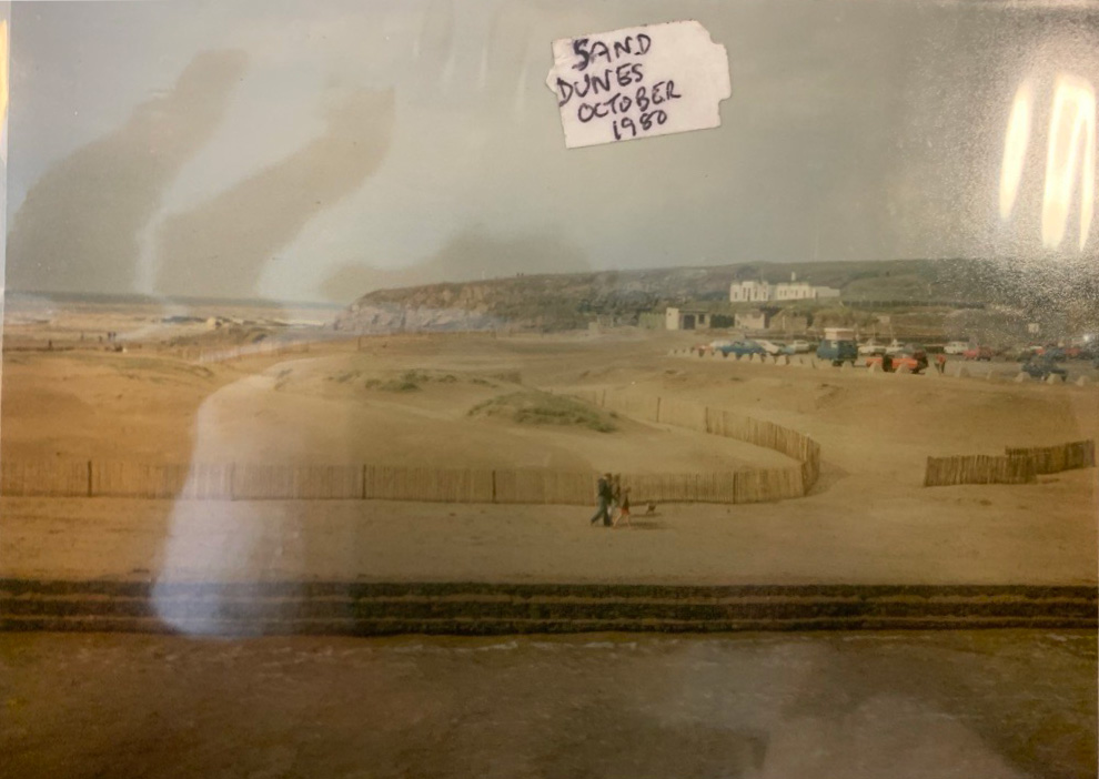
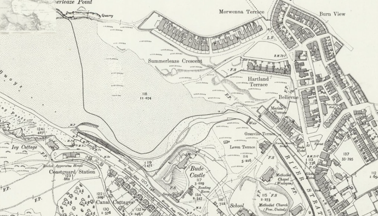
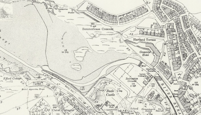
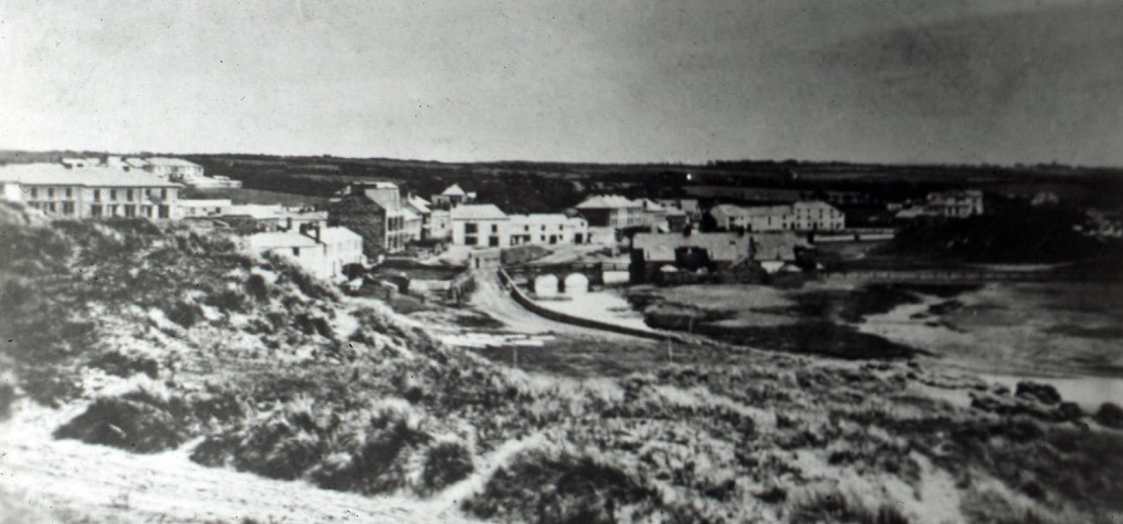
The setting of Bude has always favoured sand accumulation. Sheltered embayments at both Summerleaze and Crooklets, combined with abundant offshore sediment, , mean that dunes are not a recent feature but a long-standing part of this coastline. The construction of the breakwater in the early 19th century likely enhanced this natural tendency at Summerleaze. By reducing wave energy entering the bay, it encouraged greater sand deposition along the upper shore. However, for much of the 19th century this sand did not build into stable dunes. Instead, extensive sand mining for agricultural and industrial use repeatedly stripped material from the beach, suppressing dune formation and keeping the landscape open and mobile.
Bude Castle is not just a historic building, it is a reminder that past generations built boldly on uncertain ground.
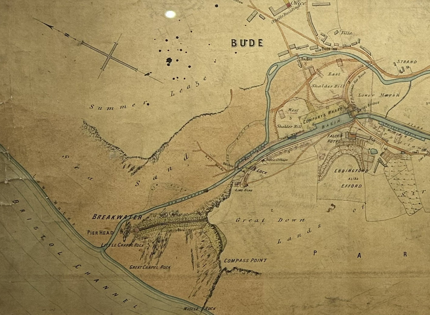
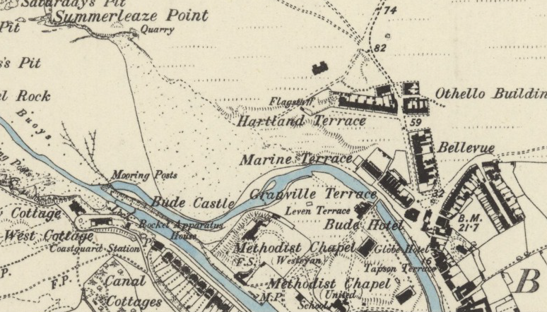
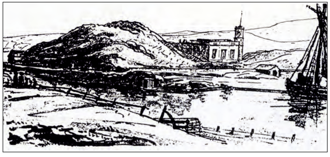
The site of Bude Castle sits on the south side of the river, at a point where the channel narrows and turns towards the harbour. This location has long played a role in shaping the course of the river, but the nature of the ground here has never been stable. Historic evidence suggests that this area was once low-lying and influenced by tidal processes, with sand and fine sediments accumulating as the river met the sea. Coastal processes, the presence of a tide mill upstream, and later the construction of the canal and breakwater are all likely to have altered how sediment was deposited here. By the early 19th century, the ground had already been heavily modified, with material excavated during canal construction probably contributing to the raised landform on which the Castle was built. Historic records show that saltworking took place in this area from at least the medieval period, and two sand-covered mounds, at the Castle and at nearby Shalder Hill, are known to pre-date the 19th-century canal construction. These mounds may represent a combination of natural sand accumulation in a tidal landscape and long-term human activity, including salt production. By the early 19th century, this was already a landscape shaped by water, sand and repeated intervention.
Before the construction of the canal, harbour and breakwater in the early 19th century, the river at Bude flowed through a very different landscape.
Before the construction of the canal, harbour and breakwater in the early 19th century, the river at Bude flowed through a very different landscape. Evidence from historic maps, charts and archaeology suggests that the river did not follow a single, fixed channel across Summerleaze. Instead, it appears to have formed a broader, more dynamic network of channels across the beach, shifting position in response to tides, storms and sand movement.
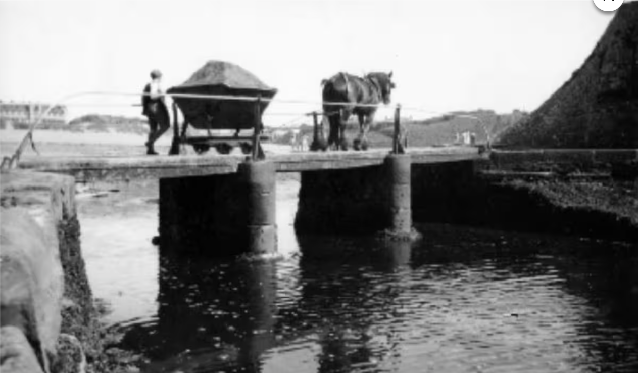
In this environment, ships did not sail directly up to a permanent quay. Instead, goods were landed in the open bay or at the river mouth using small vessels and boats adapted to shallow, shifting conditions. Coastal trading vessels would anchor offshore, with cargo transferred by small boats or landed directly onto the beach, depending on conditions. This allowed trade to function without fixed harbour works, but it relied on local knowledge and favourable tides rather than engineered control. Medieval activity along the river shows that people were already working with this changeable environment. A medieval quay is thought to have existed near what is now Granville (Quay) Cottage, one of the oldest surviving houses in Bude, dating from 1535. A medieval tide mill built in the late 16th Century, known as Efford Mill, further demonstrates how the river’s tidal reach and flow were harnessed rather than controlled. Structures such as Nanny Moore’s Bridge mark long-standing crossing points, but not a fixed channel in the modern sense. In this earlier landscape, the river, dunes and beach evolved together. A mobile river channel would have influenced where sand accumulated, shaping dune formation in ways very different from today.
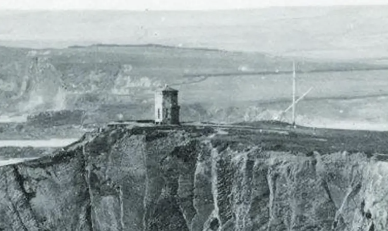
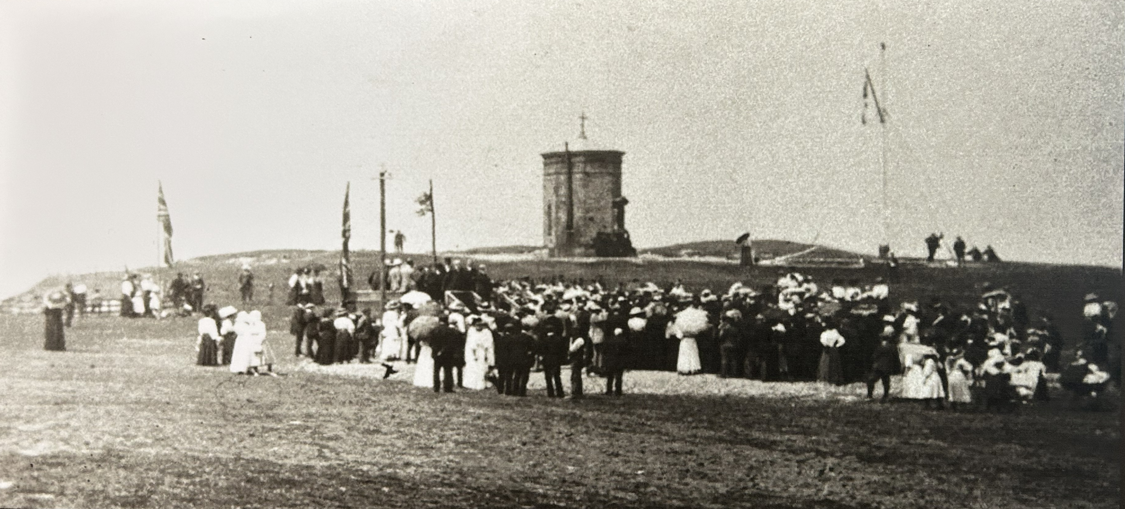
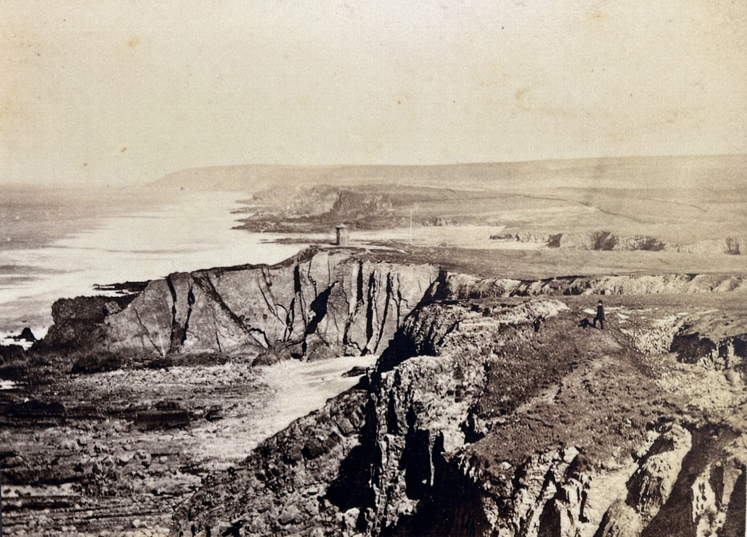
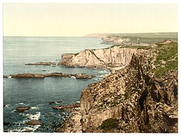
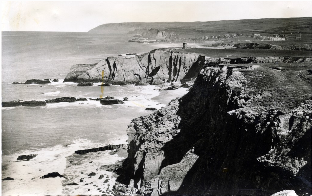
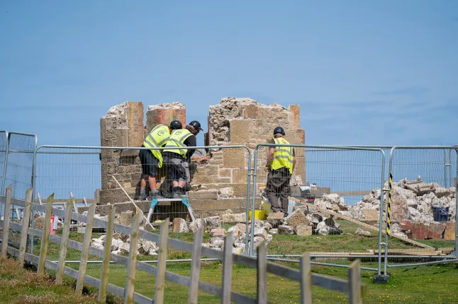
Originally built in 1835 as a coastguard lookout, its history reveals an early understanding that coastal change here is inevitable, and that survival depends on adaptation rather than defence.
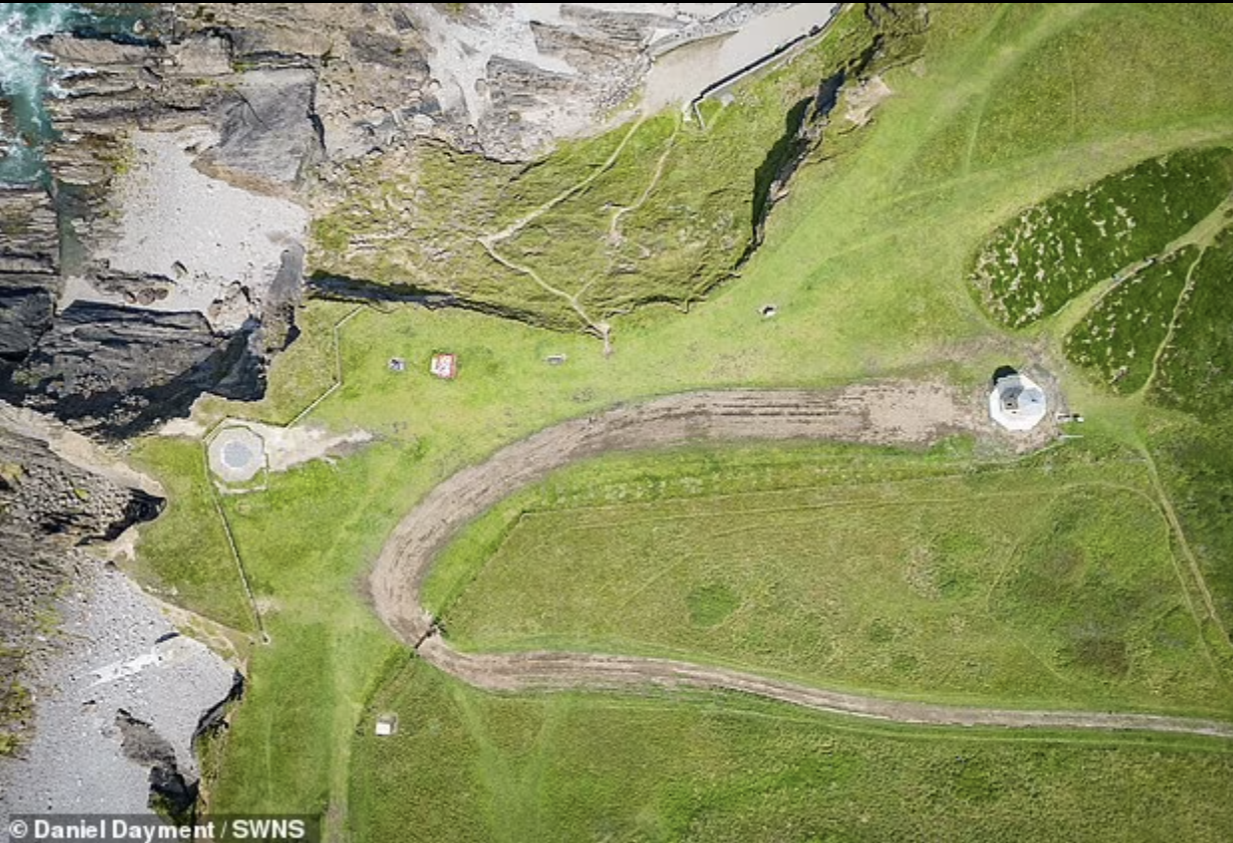
The Storm Tower stands on the exposed cliffs north of Bude at Efford Down, overlooking one of the most energetic stretches of coastline in Cornwall. Originally built in 1835 as a coastguard lookout, its history reveals an early understanding that coastal change here is inevitable, and that survival depends on adaptation rather than defence.